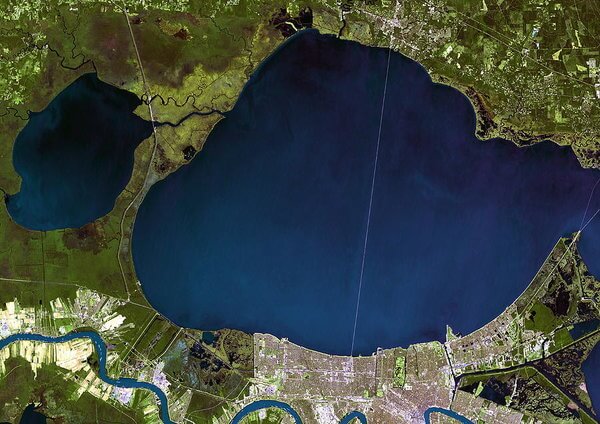
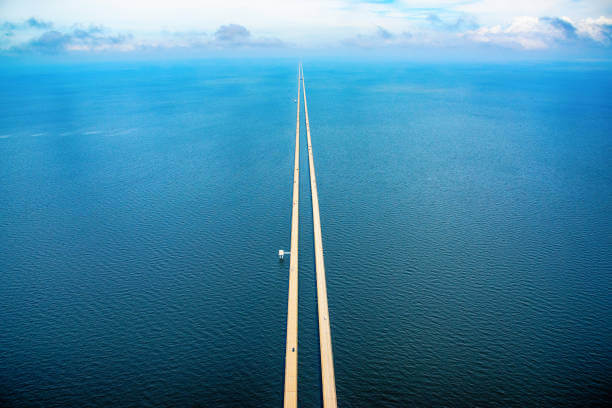
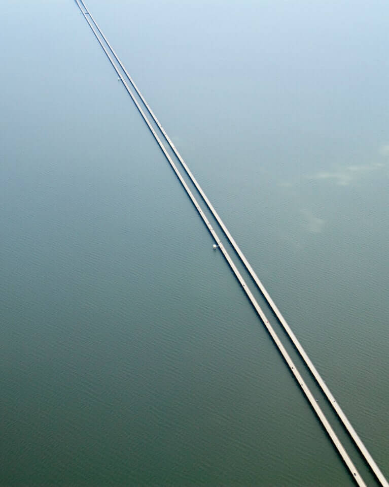
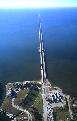
Lake Pontchartrain Causeway is located on Lake Pontchartrain in southern Louisiana, USA.The Lake Pontchartrain Causeway, sometimes only the causeway, is a fixed link composed of two parallel bridges.
Lake Pontchartrain Causeway has 2 times construction records. The two constructions were separated by 14 years. It cost 76 million US dollars total(between 1955-1969).
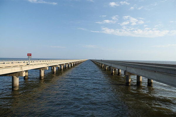
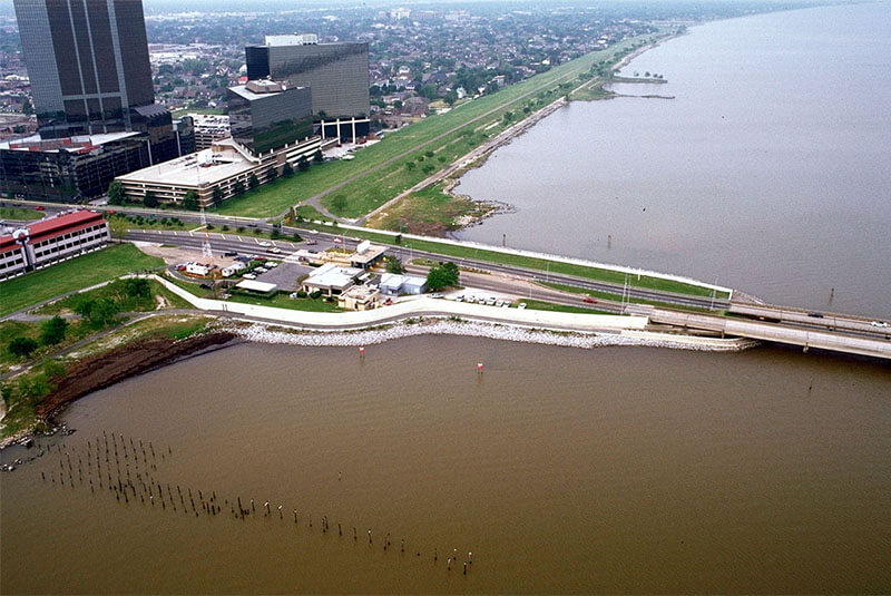
The longer of the two bridges is 23.83 miles (38.35 km) long. The southern terminus of the causeway is in Metairie, Louisiana, a suburb of New Orleans. The northern terminus is at Mandeville, Louisiana.
The bridges are supported by 9,500 concrete pilings.
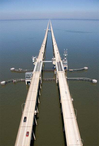
The two bridges feature a bascule, which spans the navigation channel 8 miles (13 km) south of the north shore.
Construction history
On May 23, 1955, the Louisiana Bridge Company carried out construction work. The first two-lane span to build the causeway took only 14 months and was opened on August 30, 1956, with a total length of 23.86 miles,Cost of $46 million. This included not just the bridge, but three approach roads on the north end and a long stretch of road on the south end.
As traffic increased, the first span reached capacity and another was built, opening in 1969. A parallel two-lane span, 1/100th of a mile (15 m) longer than the original,separated from the original by about 84 feet. opened on May 10, 1969, at a cost of $30 million.
Construction significance
The opening of the causeway boosted the fortunes of small North Shore communities by reducing drive time into New Orleans by up to 50 minutes, bringing the North Shore into the New Orleans metropolitan area.
Guinness World Records controversy
For decades Lake Pontchartrain Causeway was listed by Guinness World Records as the longest bridge over water in the world.
In July 2011 the Jiaozhou Bay Bridge in China was named by Guinness World Records as the ‘longest bridge over water’.
At that time there was some controversy in the United States as supporters of the former holder of the record, the Lake Pontchartrain Causeway, disagreed with Guinness World Records not calling the causeway the longest.
Supporters made this claim based on its own definition i.e., the length of a bridge physically over water and concluded that the Lake Pontchartrain Causeway spans 38.28 km (23.79 mi) and was therefore the longest. The Jiaozhou Bay Bridge spans water for only 25.9 km (16.1 mi).
However, Guinness World Records, using the criteria of measurement that included aggregate structures, such as land bridges on the ends and an under-sea tunnel, stated that the Jiaozhou Bay Bridge is 42.6 km (26.5 mi) long.
Following this controversy in July 2011, Guinness World Records created two categories for bridges over water: continuous and aggregate lengths over water.
Lake Pontchartrain Causeway became the longest bridge over water(continuous) .
Jiaozhou Bay Bridge became the longest bridge over water(aggregate).
What’s the Difference between a bridge and a causeway?
A Bridge is a structure which allows passage over some type of impediment to travel (such as a roadway over a river, or other body of water).
Causeways tend to refer to roadways which are close to the surface of the water or wetlands they provide passage over, and often do not allow nautical navigation underneath them.
Toll
Since its construction, the causeway has operated as a toll bridge. Until 1999, tolls were collected from traffic going in each direction. To alleviate congestion on the south shore, toll collections were eliminated on the northbound span. In May 1999, the standard tolls for cars changed from $1.50 in each direction to a $3 toll collected on the North Shore for southbound traffic.
In 2017, the toll was raised to fund safety improvements on the bridge. The toll changed from $3.00 with cash and $2.00 with a toll tag to $5.00 with cash and $3.00 with a Toll Tag.
Lake Pontchartrain Causeway Data
- Country
- America
- Location
- Metairie and Mandeville, Louisiana, U.S.
- Constructed by
- Louisiana Bridge Company(southbound) Prestressed Concrete Products,Inc.(northbound)
- Cost
- $76 million(2 times)
- Status
- In use
- Maintained by
- Causeway Commission
- Began
- May-23, 1955(southbound) Jun, 1967(northbound)
- Opened
- Aug-30, 1956(southbound) May 10, 1969(northbound)
- Total Duration
- 3 years total(2 times)
- Length
- 25 mi (38.5 km)
- Bridge section length
- 25 mi (38.5 km)
- Width
- 8.5 m (27.9 ft)
- Deck height
- 4.7 m (15 ft)
- Design type
- Low-level trestle with mid-span bascule
- Bridge type
- Lake bridge
- Crosses
- Lake Pontchartrain
- Road scale
- 4 lanes
- Toll
- $5.00 (southbound)
View Lake Pontchartrain Causeway on Google Satellite Map
Google satellite maps allow you to see building details more clearly, including natural landscapes such as mountains, rivers, deserts, sea and man-made engineering buildings.
If you are very interested in this engineering building, it is a good idea to click below Google Map icon. We will help you jump to the corresponding location of this building or engineering on Google satellite map.


