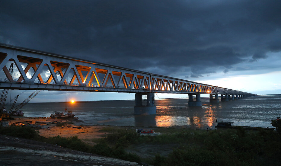
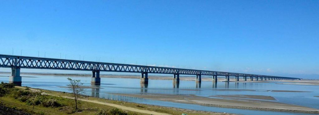
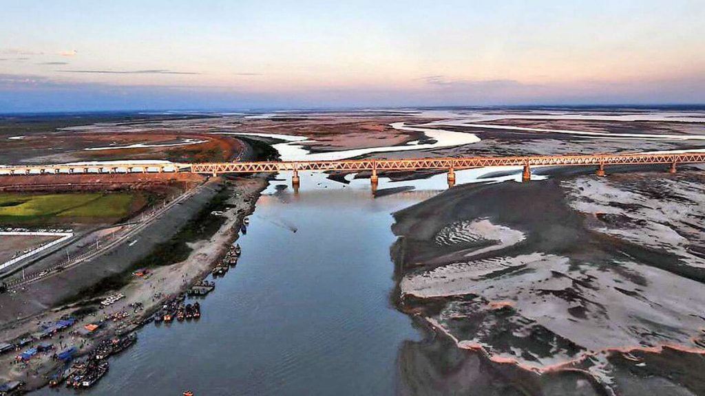
Bogibeel Bridge is located in Assam, the easternmost part of India, close to Tibet of China. It connects Dhemaji and Dibrugarh. It crossed the Brahmaputra River that originated in China.
The length of the bridge is 3.6 mi (5.8 km), and the Length over water is 3 mi (4.8 km). The length of the road-rail composite section is 3.1 mi (4.9 km). The foundation stone laying ceremony of this bridge was held in 2002. Due to funding reasons, it was not opened to traffic until December 25, 2018. It cost 60 billion INR (US $840 million ).
This bridge is of great significance to India’s national defense. It improves India’s ability to transport troops and materials to the eastern region bordering China.
History
Origin Project
- May 25, 1977: A crucial decision was made at a public meeting in Dibrugarh to build Bogibeel, India’s longest railway and road bridge.
- 1985: According to the “Assam Agreement”, the bridge project is one of several major infrastructures planned to be established in Assam.
- 1997-1998: Indian President HD Deve Gowda decided that the bridge will be completed before the end of the ninth 5-year plan.
Groundbreaking ceremony and shutdown
- April 21, 2002: Former Prime Minister Atal Bihari Vajpayee unveiled the construction site and construction of the bridge began. However, due to lack of funds and attention, the bridge was subsequently suspended.
- 2007: Bogibeel Bridge was promoted to a national project in India, the Federal Ministry of Finance contributed 75% of the project’s cost, and the Ministry of Railways only contributed 25%. Therefore, the Federal Ministry of Finance contributed 75% of the project cost, while the Ministry of Railways contributed the rest.
- April 2008: Northeast Frontier Railway Company signed a contract with India’s Gammon to build the lower structure of the bridge, while the consortium of Hindustan Construction Company, German DSDBrückenbau GmbH and VNR Infrastructure won the contract to build the upper structure.
Formal construction
- 2011: The construction of the main bridge officially started.
- December 2, 2018: The bridge opens when the first freight train crosses the bridge.
- On December 25, 2018, Indian Prime Minister Modi attended the opening ceremony of the bridge.
Building technical parameters
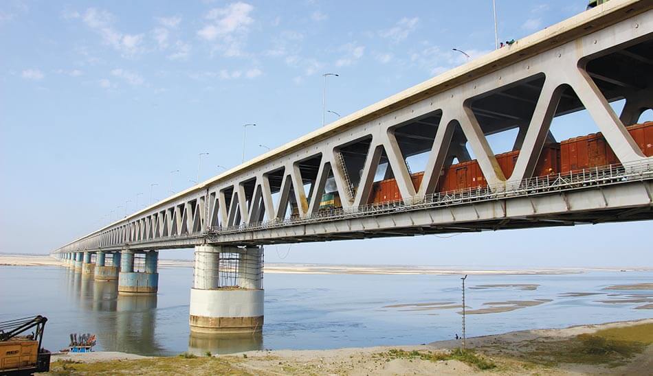
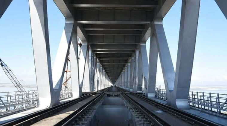
The Bogibeel Bridge is 3.6 mi (5.8 km) long, and Length over water is 3 mi (4.8 km ). Its span is 135 ft (41 m), the longest span is 410 ft (125 m), and the bridge body is constructed of welded steel trusses and reinforced concrete.
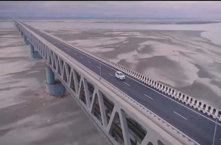
As part of India’s National Highway 15, the bridge is a double-layered road and rail bridge. The length of the road-rail composite section is 3.1 mi (4.9 km).
Upper road bridge
The upper level of the bridge is a 3-lane highway.
Lower railway bridge
The lower level of the bridge is a 2-line railway. The width of each railway is 5 ft (1.6 m).
Features
Since it is located in an earthquake-prone area, it is the first bridge in India with a fully welded reinforced concrete support beam that can withstand earthquakes with a magnitude of 7 on the Richter scale.
The designed service life of the bridge is approximately 120 years. It cost 60 billion INR (US $840 million ).
Bogibeel Bridge Data
- Country
- India
- Region
- South Asia
- Status
- In use
- Location
- Dhemaji district and Dibrugarh district, Assam, India
- Contractor
- Hindustan Construction Company (HCC), Gammon India
- Cost
- 60 billion INR ( US $840 million )
- Design life
- 120
- Began
- Apr-21, 2002
- Construction end
- Dec-01, 2018
- Opened
- Dec-25, 2018
- Total length
- 3.6 mi ( 5.8 km )
- Length over water
- 3 mi ( 4.8 km )
- Bridge section length
- 3.6 mi ( 5.8 km )
- Longest span
- 410 ft ( 125 m )
- Design type
- Truss bridge
- Road scale
- 3 road lanes, 2 rail tracks
- Crosses
- Brahmaputra River
View Bogibeel Bridge on Google Satellite Map
Google satellite maps allow you to see building details more clearly, including natural landscapes such as mountains, rivers, deserts, sea and man-made engineering buildings.
If you are very interested in this engineering building, it is a good idea to click below Google Map icon. We will help you jump to the corresponding location of this building or engineering on Google satellite map.


