Runyang Yangtze River Bridge ( Chinese:润扬长江公路大桥 ) is located on the Yangtze River in Jiangsu Province, China. It connects Zhenjiang City and Yangzhou City and is called Runyang Bridge for short.
Construction of the Runyang Yangtze River Highway Bridge started on October 20, 2000, and was completed on June 1, 2004. The main project was basically completed on February 2, 2005, and officially opened to traffic on April 30, 2005.
The total length of the bridge is 22.2 mi (35.7 km), the deck is a two-way 6-lane highway, and the design speed is 100 km/h; it cost 5.8 billion yuan (about US $700 million).

History
Historical planning
- During the Qing Dynasty in ancient China, Yangzhou scholar Wang Zhong (1744—1794) wrote the “Proposal on Building a Floating Bridge in Jingkou” and became the first to propose the construction of the Runyang Yangtze River Bridge.
- In 1919, the famous modern Chinese statesman Sun Yat-sen planned two Yangtze River bridges, one is the Wuhan Yangtze River Bridge, and the other is the downstream Runyang Yangtze River Bridge.

Modern construction
- In November 1992, China’s Jiangsu Provincial Transportation Planning and Design Institute began to conduct a feasibility study of the Runyang Yangtze River Bridge.
- In March 1998, the former State Planning Commission of China agreed to build the Runyang Yangtze River Bridge.
- On July 1, 2000, the test pile project of Zhenjiang Yangzhou Yangtze River Highway Bridge was drilled; on August 8, the former Ministry of Communications officially approved the preliminary design of the bridge; on October 13, the bridge was officially named “润扬长江公路大桥”.
- On October 20, 2000, the groundbreaking ceremony of Runyang Yangtze River Highway Bridge was held. The then Chinese President Jiang Zemin attended, marking the official start of construction of Runyang Yangtze River Highway Bridge.
- On October 30, 2001, the back cover of the two main towers of the North Channel Bridge was completed.
- On January 28, 2003, the closure project of the North Channel Bridge was completed; on October 1, the same year, the erection of the main cable of the South Channel Bridge was successfully completed.
- On April 17, 2004, the suspension and closure project of the South Channel Bridge was completed; on June 1, the Runyang Yangtze River Highway Bridge was fully connected; on September 23, the steel deck paving project of the Runyang Yangtze River Highway Bridge was completed.
- On February 2, 2005, the main project of Runyang Yangtze River Highway Bridge was basically completed.
- On April 30, 2005, Runyang Yangtze River Highway Bridge was officially opened to traffic.

Building design parameters
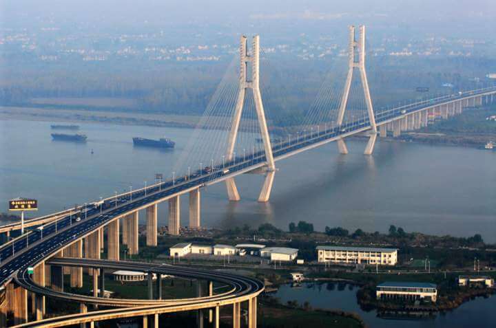
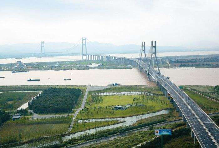
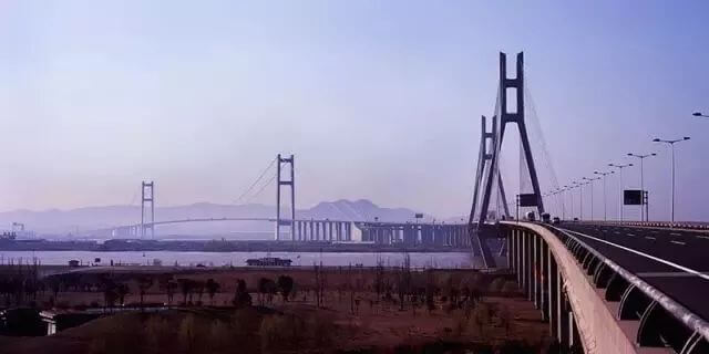
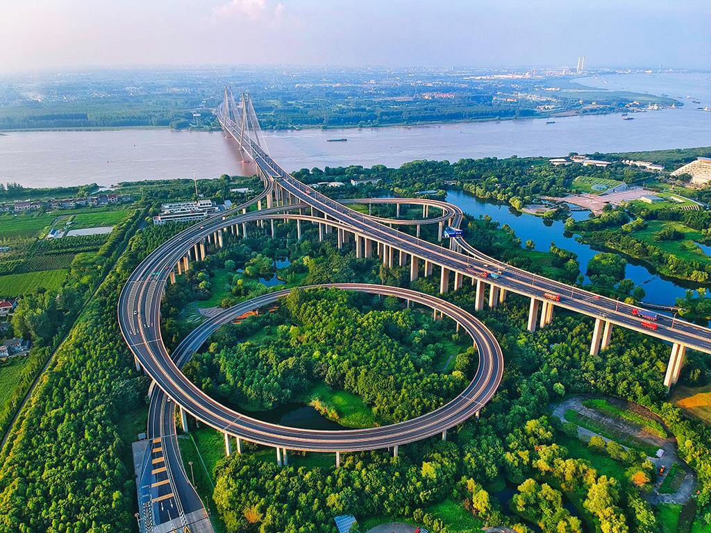
Runyang Yangtze River Highway Bridge is a combined bridge consisting of two long-span channel bridges and their approach bridges. The full bridge is composed of the North Link, the North Channel Bridge, the Shiye Island Interchange Viaduct, the South Channel Bridge, the South Link and the extension section. .

Runyang Yangtze River Highway Bridge is 22.2 mi (35.7 km) long, the main bridge (including North Channel Bridge, Shiyezhou Interchange Viaduct and South Channel Bridge) is 4.5 mi (7.2 km) long, and the North Approach Bridge is 1.1 mi (1.7 km) long. The north line is 6.4 mi (10.3 km) long, and the south line and its extension are 10.2 mi (16.4 km) long. The full width of the bridge deck is 107 ft (32.5 m).
Runyang Yangtze River Bridge is a two-way 6-lane expressway with a design speed of 100 km/h, which can withstand a magnitude 7 earthquake.
Runyang Yangtze River Bridge has a service life of 100 years. It cost 5.8 billion yuan (about US $700 million).

At the site of Runyang Yangtze River Bridge, the Yangtze River is divided into two waterways in the north and south by Shiye Island.
- The South Channel is the mainstream of the Yangtze River, mainly through sea vessels and fleets.
- The navigable height of the South Channel is 164 ft (50 m) for seagoing ships and 79 ft (24 m) for river ships. The navigable widths are: 1280 ft (390 m) for seagoing ships and 2297 ft (700 m) for river ships.
- South Channel Bridge: 1 hole 2 hinged steel box girder suspension bridge. The main span is 4888 ft (1490 m) and the main tower is 707 ft (215.6 m) high.
- The North Channel is a tributary, mainly navigating ships under 200 tons.
- The navigable height of the North Channel is 59 ft (18 m) and the navigable width is 689 ft (210 m).
- North Channel Bridge: 3 spans, 2 towers and 2 cable planes steel box girder cable-stayed bridge. A three-span design of 176m+406m+176m is adopted.
The approach bridges are all prestressed concrete continuous box girder bridges.

Runyang Yangtze River Bridge Data
- Country
- China
- Region
- East Asia
- Status
- In use
- Official name
- 润扬长江公路大桥
- Other name
- Runyang Bridge, Runyang Yangtze River Highway Bridge
- Location
- Between Zhenjiang City and Yangzhou City, Jiangsu, China
- Maintained by
- Jiangsu Runyang Bridge Development Co., Ltd.
- Cost
- 5.8 billion yuan (about US $700 million)
- Design life
- 100
- Began
- Oct-20, 2000
- Construction end
- Feb-02, 2005
- Opened
- Apr-30, 2005
- Total length
- 22.2 mi ( 35.7 km )
- main bridge length
- 4.5 mi ( 7.2 km )
- Tall (tower)
- 707 ft ( 215.6 m )
- Width
- 107 ft ( 32.5 m )
- Longest span
- 4888 ft ( 1490 m )
- Design type
- Suspension bridge, Cable-stayed bridge
- Design speed
- 100 km / h
- Road scale
- 6 lanes
- Crosses
- Yangtze River
View Runyang Yangtze River Bridge on Google Satellite Map
Google satellite maps allow you to see building details more clearly, including natural landscapes such as mountains, rivers, deserts, sea and man-made engineering buildings.
If you are very interested in this engineering building, it is a good idea to click below Google Map icon. We will help you jump to the corresponding location of this building or engineering on Google satellite map.
View Runyang Yangtze River Bridge on 720yun
720yun is a panoramic image service provider, where you can see the panoramic image of the Engineering Building, let you know more about the Engineering Building.


