Chesapeake Bay Bridge–Tunnel (CBBT) is a 17.6-mile (28.3 km) bridge–tunnel crossing at the mouth of the Chesapeake Bay, the Hampton Roads harbor, and nearby mouths of the James and Elizabeth Rivers in the U.S.state of Virginia.
Chesapeake Bay Bridge–Tunnel connects Northampton County on the Delmarva Peninsula and Eastern Shore with Virginia Beach, Norfolk, Chesapeake, and Portsmouth on the western shore and south side / Tidewater which are part of the Hampton Roads metropolitan area of eight close cities around the harbor’s shores and peninsula.
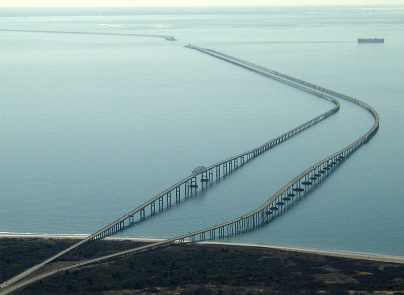
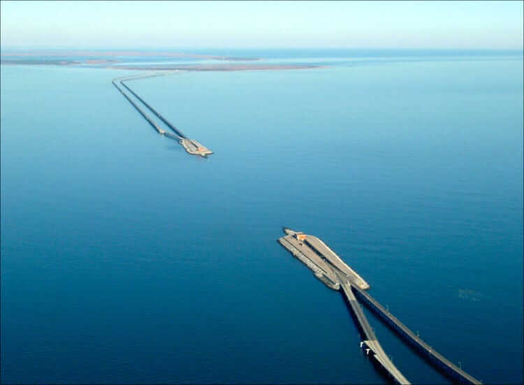
Chesapeake Bay Bridge–Tunnel originally combined 12 miles (19 km) of trestle, two 1-mile-long (1.6 km) tunnels, four artificial islands, four high-level bridges, approximately 2 miles (3.2 km) of causeway, and 5.5 miles (8.9 km) of northeast and southwest approach roads—crossing the Chesapeake Bay and preserving traffic on the Thimble Shoals and Chesapeake dredged shipping channels leading to the Atlantic.
Cost
The original 2-lane bridge-tunnel facility was opened in April 1964, took 4 years to build, and it cost $200 million for planning, design, right-of-way, and construction.
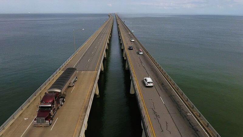
From 1995 to 1999, at an additional cost of almost $200 million, the capacity of the above-water portion of bridges on the facility was increased and widened to four lanes.
Parallel Thimble Shoal Tunnel (projected 2017–2023)
In 2013, the CBBT Commission approved a project to construct the Parallel Thimble Shoal Tunnel, with cost estimated at $756 million.
The project received three bids, all of which would use a tunnel boring machine.
The winning company was German-based Herrenknecht, whose machine was 325 ft (99 m) long.
The machine, nicknamed Chessie in a naming contest, was capable of removing 2.4 in (61 mm) of soil per minute, or about 50 ft (15 m) per day. At that rate, it was estimated that the tunnel would be dug within about one year.
Construction work began in 2017 to prepare the location of the tunnels, with a pier, shop, and restaurant closed in September 2017.
The machine was built in 2018, after some delays, and was shipped to Virginia.
Construction is scheduled to begin in 2020, and finish in 2023.
Chesapeake Bay Bridge + Shoal Tunnel + Trestle(0.2 + 0.75 + 0.19 = 1.15 billion).
The total cost is $ 1.15 billion.
Dimensions
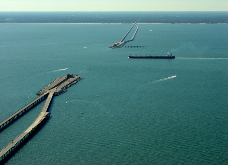
Among the key features of the Chesapeake Bay Bridge–Tunnel are two 1-mile (1.6 km) tunnels beneath the Thimble Shoals and Chesapeake navigation channels and two pairs of side-by-side high-level bridges over two other navigation channels: North Channel Bridge (75 ft or 22.9 m clearance) and Fisherman Inlet Bridge (40 ft or 12.2 m clearance).
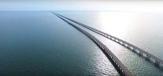
The remaining portion comprises 12 miles (19 km) of low-level trestle, 2 miles (3.2 km) of causeway, and four man-made islands.
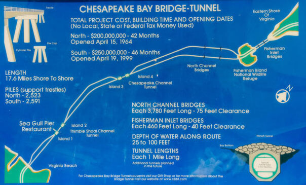
The CBBT is 17.6 miles (28.3 km) long from shore to shore, crossing what is essentially an ocean strait. Including land-approach highways, the overall facility is 23 miles (37 km) long (20 miles or 32 kilometres from toll-plaza to toll-plaza) and despite its length, there is only a height difference of 6 inches (152 mm) from the south to north end of the bridge–tunnel.
Exclude highways on the island and tunnels,The Bridge section length is 14.9 miles (24.1 km).
Man-made islands, each approximately 5.25 acres (2.12 ha) in size, are located at each end of the two tunnels.
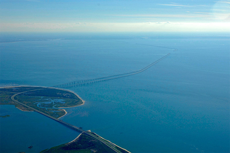
Between North Channel and Fisherman Inlet, the facility crosses at grade over Fisherman Island, a barrier island which is part of the Eastern Shore of Virginia National Wildlife Refuge administered by the U.S. Fish and Wildlife Service.
The columns that support the bridge–tunnel’s trestles are called piles. If placed end to end, the piles would stretch for about 100 miles (160 km), roughly the distance from New York City to Philadelphia.
Tourism
On the Delmarva peninsula to the north of the bridge, travelers may visit nearby Kiptopeke State Park, Eastern Shore National Wildlife Refuge, Fisherman Island National Wildlife Refuge (closed to the public), campgrounds and other vacation destinations.
To the south are tourist destinations around Virginia Beach, including First Landing State Park, Norfolk Botanical Garden, Virginia Beach Maritime Historical Museum, Atlantic Wildfowl Heritage Museum, and the Virginia Aquarium and Maritime Science Center.
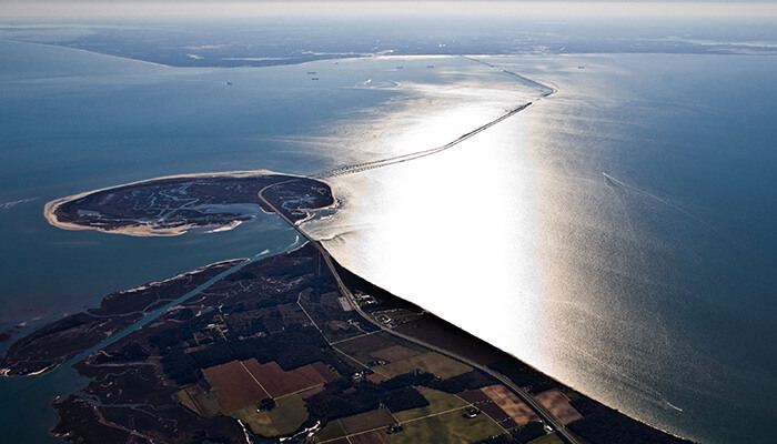
A scenic overlook is located at the north end of the bridge and was formerly located at South Thimble Island, near the south end. At South Thimble Island, passing ships may include U.S. Navy warships, nuclear submarines, and aircraft carriers, as well as large cargo vessels and sailing ships.
A restaurant and gift shop on the island opened in 1964, along with the 625-foot-long (191 m) Sea Gull Pier. Bluefish, trout, croaker, flounder, and other species have been caught from the pier.
Since birds use the habitat created by the bridges and islands of the CBBT, birders have travelled to the bridge–tunnel to see them at South Thimble Island and the scenic overlook at the north end.
As part of the Thimble Shoal Channel Tunnel twinning, the building housing the restaurant and gift shop closed and access to the pier was prohibited starting at the end of September 2017. The building will be demolished and not replaced, and the pier will reopen to the public at the end of the project in 2022.
Chesapeake Bay Bridge–Tunnel Data
- Country
- America
- Location
- Virginia Beach and Norfolk, Chesapeake, Portsmouth to Cape Charles, Virginia, U.S.
- Official name
- Lucius J. Kellam Jr. Bridge–Tunnel
- Cost
- Chesapeake Bay Bridge + Shoal Tunnel + Trestle (0.2b + 0.75b + 0.19b = $ 1.15 billion)
- Status
- In use
- Maintained by
- Chesapeake Bay Bridge and Tunnel Commission
- Began
- Oct, 1960
- Opening date
- April 15, 1964 (northbound) April 19, 1999 (southbound)
- Total Duration
- 4 years
- Length
- 23 miles (37 km)
- Bridge section length
- 17.6 miles (28.3 km)
- Deck height
- 75 feet (22.9 m) (North Channel) 40 feet (12.2 m) (Fisherman Inlet)
- Design type
- Fixed link: low-level trestle, single-tube tunnels, artificial islands, truss bridges, high-level trestle
- Bridge type
- Cross sea bridge
- Crosses
- Chesapeake Bay
- Road scale
- 4 lanes (4 on bridges, 2 in tunnels)
View Chesapeake Bay Bridge–Tunnel on Google Satellite Map
Google satellite maps allow you to see building details more clearly, including natural landscapes such as mountains, rivers, deserts, sea and man-made engineering buildings.
If you are very interested in this engineering building, it is a good idea to click below Google Map icon. We will help you jump to the corresponding location of this building or engineering on Google satellite map.


[…] Chesapeake Bay Bridge–Tunnel is a 17.6-mile (28.3 km) bridge–tunnel crossing at the mouth of the… […]