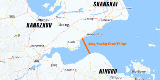
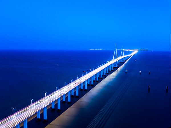
Hangzhou Bay Bridge(chinese:杭州湾大桥) is located in Hangzhou Bay, Zhejiang Province, China. It is a 36 km (22.4 mile) highway bridge across the sea. It connects Jiaxing City and Ningbo City in Zhejiang Province.
The total length of the Hangzhou Bay Bridge is 36 kilometers, and the bridge section is 35.7 kilometers. The bridge deck is a two-way six-lane highway with a design speed of 100 kilometers per hour.
The total investment of Hangzhou Bay Bridge was 13.8 billion yuan (US $ 2.1 billion) in 2003.
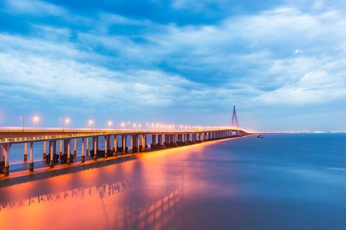
The Hangzhou Bay Bridge starts from the Pinghu Interchange in Zhengjiadai Village, Haiyan, Jiaxing City in the north, crosses the water area of Hangzhou Bay, and reaches the east interchange of the Anhui Hub in Cixi Shuiluwan, Ningbo City in the south.
The offshore platform “Haitian Yizhou” is located in the middle of the Hangzhou Bay Bridge, 1.7 kilometers south of the South Channel.
overall arrangement
The Hangzhou Bay Cross-sea Bridge is composed of an offshore platform, a hole bridge in the north-south channel, an approach bridge in the water area, an approach bridge in the tidal flat area, an approach bridge in the land area, various bridge towers and overpass ramps.
The main buildings are:
North Fairway Bridge, South Fairway Bridge, and Maritime Platform.
North Channel Bridge
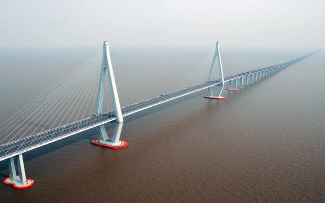
The Beihangdao Bridge adopts (70 + 160 + 448 + 160 + 70) meter span layout.
The North Channel Bridge uses a diamond-shaped double-tower cable-stayed bridge, a semi-floating system, and a five-span continuous structure.
South Channel Bridge
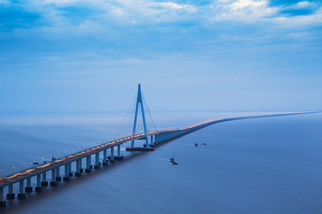
The South Channel Bridge adopts (100 + 160 + 318) meters span arrangement.
The South Channel Bridge adopts A-shaped single-tower cable-stayed bridge with a three-span continuous structure.
Offshore Platform
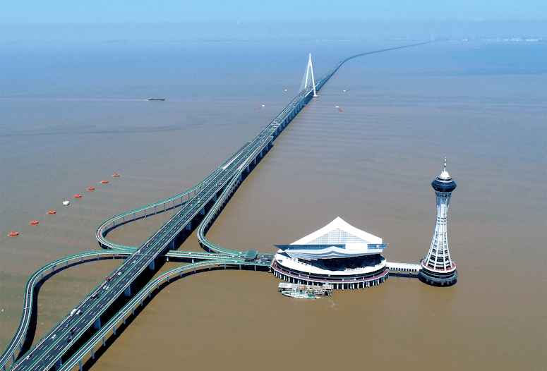
The name of the platform in the sea is “Haitianyizhou” (Chinese: Haitianyizhou), which means the only land between the sea and the sky. Its shape is like an eagle about to fly.
“Haitian Yizhou” is divided into two parts: a sightseeing platform and a sightseeing tower.
Sightseeing platform
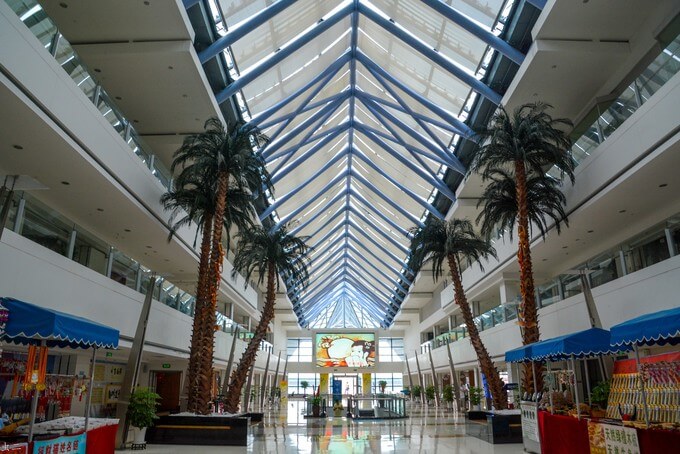
The total area of the platform in the sea is 12,000 square meters, of which the building area of the platform house is 36617 square meters, with a total of 6 floors;
The sightseeing platform provides comprehensive special services such as catering, accommodation, leisure, entertainment, sightseeing and shopping;
Sightseeing tower
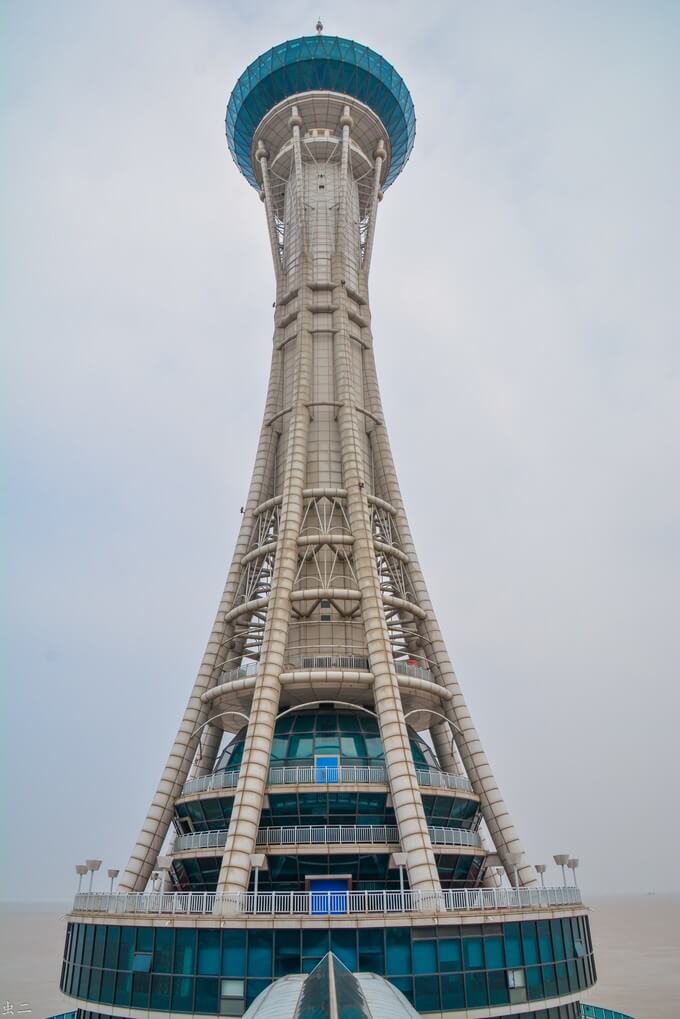
The total construction area of the sightseeing tower is 5100 square meters, with 16 floors in total, and the building height is 145.6 meters.
The Sightseeing Tower allows passengers to stand at the commanding heights and look down on the magnificent bridge, and the magnificent Hangzhou Bay is magnificent.
Ticket fare
The charges for the Hangzhou Bay Cross-sea Bridge are: 80 yuan per vehicle for first-class vehicles; 160 yuan per vehicle for second-class vehicles; 240 yuan per vehicle for third-class vehicles; 280 yuan per vehicle for fourth-class vehicles; and 320 yuan per vehicle for five-class vehicles.
During the special statutory holidays in Mainland China, small buses will pass the Hangzhou Bay Cross-sea Bridge at no charge and all sections will be free of charge.
Value Significance
After the completion of the Hangzhou Bay Cross-sea Bridge, the distance between Ningbo, Zhoushan and the city on the northern shore of Hangzhou Bay was shortened, saving transportation time, reducing transportation costs, reducing traffic accidents, and improving transportation efficiency, thus forming the Hangzhou Bay Cross-sea The channel benefit of the bridge.
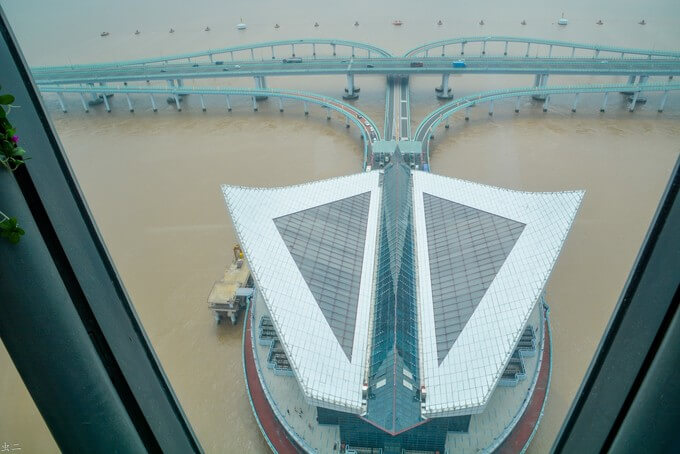
At the same time, the bridge has changed the layout of the transportation network in the surrounding area, promoted the integration of regional transportation, and improved the logistics network in the surrounding area. It has brought varying degrees of impact on highways, ports, aviation, and railways.
Construction history
On June 8, 2003, construction of the Hangzhou Bay Bridge began.
On March 16, 2004, the Hangzhou Bay Bridge project entered the stage of full-scale construction.
2007
On May 26, 2007, Hangzhou Bay Bridge completed the construction of the North Shore Approach Bridge.
On June 11, Hangzhou Bay Bridge completed the Helong project of the South Channel Bridge;
On June 13, the Hangzhou Bay Bridge completed the Helong project of the North Channel Bridge;
On June 26, 2007, the Hangzhou Bay Bridge completed the Helong project of the whole bridge section, and the whole line was completed.
On May 1, 2008, the Hangzhou Bay Bridge was opened to traffic.
On December 29, 2010, the “Haitian Yizhou” offshore platform of Hangzhou Bay Bridge was put into operation.
Hangzhou Bay Bridge Data
- Country
- China
- Location
- Between Jiaxing City and Ningbo City in Zhejiang Province
- Official name
- 杭州湾跨海大桥
- Cost
- 13.8 billion yuan (US $2.1 billion )
- Status
- In use
- Maintained by
- Hangzhou Bay Bridge Development Co., Ltd.
- Design life
- 100 years
- Began
- Jun-08, 2003
- Construction end
- Jun-26, 2007
- Opened
- May-01, 2008
- Total Duration
- 4 years
- Length
- 22.4 mi (36 km)
- Bridge section length
- 22.2 mi (35.7 km)
- Width
- 33 m (108 ft)
- Longest span
- 448 m (1,470 ft)
- Design type
- Cable-stayed bridge
- Bridge type
- Cross sea bridge
- Crosses
- Hangzhou Bay
- Road scale
- 6 lanes
- Design speed
- 100 km / h
- Toll
- ¥80-320 Yuan(About $11-43)
View Hangzhou Bay Bridge on Google Satellite Map
Google satellite maps allow you to see building details more clearly, including natural landscapes such as mountains, rivers, deserts, sea and man-made engineering buildings.
If you are very interested in this engineering building, it is a good idea to click below Google Map icon. We will help you jump to the corresponding location of this building or engineering on Google satellite map.


