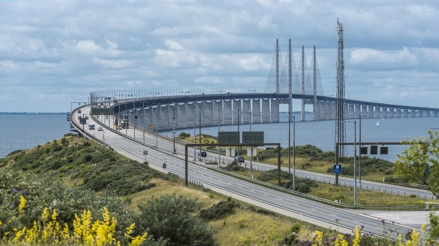
Øresund Bridge ( Danish: Øresundsbroen; Swedish: Öresundsbron ) is located on Øresund strait between Denmark and Sweden. It is a road and railway bridge.
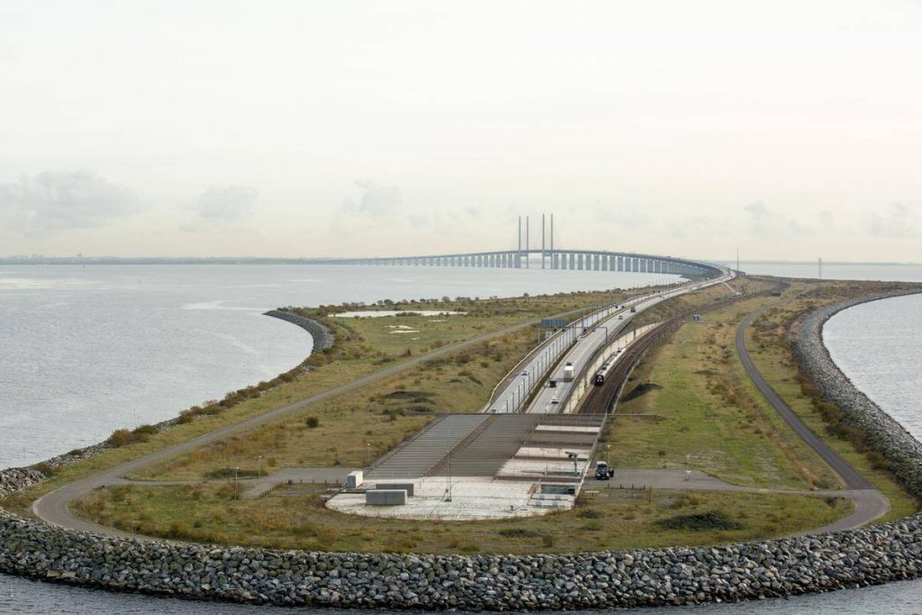
The east end of the bridge is the Swedish coast, and the west end is the man-made island Peberholm in the middle of the strait. The island is 4 kilometers (2.5 miles) from the Danish island of Amager and 8 kilometers (5 miles) from the Swedish coast.
The total length of the Øresund Bridge link is 9.9 mi (16 km ), the length of the bridge section is 4.9 mi (7.8 km ), and the Longest span is 1608 ft (490 m ). It was the longest road and rail bridge in Europe from 2009 to 2018. It connected the Danish capital Copenhagen with the Swedish city of Malmö. It was later defeated by Russia’s Crimean Bridge.
Construction began in 1995 and the bridge opened to traffic on July 1, 2000. It total cost about 19.6 billion DKK/25.8 billion SEK (US $3.1 billion ).
History
- March 23, 1991: Sweden and Denmark sign an agreement to build a fixed link across Øresund.
- September 16, 1993: Work begins on the Danish landworks which comprise 9 km motorway and 18 km railway.
- August 1995: Work on the coast-coast link begins with dredging operations in Øresund.
- April 1, 1997: The first of the two foundations for the high bridge pylons are towed from Malmö to the bridge alignment and lowered into a 17 m deep trench excavated in the sea bed.
- August 8, 1997: The first of the 20 tunnel elements are towed from the factory at Copenhagen’s North Harbour to Drogden where they are lowered into the dredged tunnel trench.
- March 16, 1999: The tunnel is completed and the first vehicle drives through it.
- August 14, 1999: As the final bridge section is placed in position, the link between Denmark and Sweden becomes a reality.
- December 1, 1999: The final section of the railway between Copenhagen and Malmö is placed in position.
- June 9 – 12, 2000: The Øresund Bridge opens to the public. Hundreds of thousands of people cycle, run or walk across the link during the special “Open Bridge” days.
- July 1, 2000: Inauguration of the Øresund Bridge.
- The Øresund Bridge won the 2002 IABSE Outstanding Structure Award.
The main structure
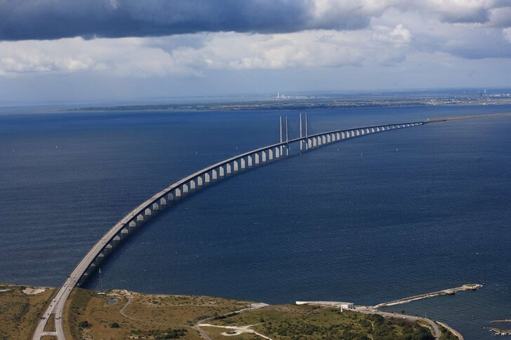
The Øresund Bridge is an approximately 9.9 mi ( 16 km ) long road and rail link between Sweden and Denmark. It consists of three sections: a bridge, an artificial island and a tunnel.
Bridge
大桥长4.9 mi ( 7.8 km ), and the Longest span is 1608 ft (490 m ).
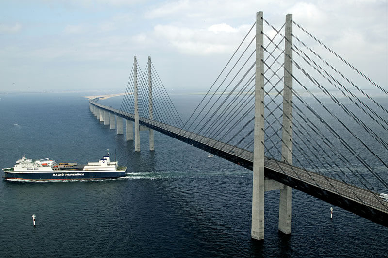
The structure has a mass of 82,000 tonnes and supports two railway tracks beneath four road lanes in a horizontal girder extending along the entire length of the bridge. On both approaches to the three cable-stayed bridge sections, the girder is supported every 140 m (459 ft) by concrete piers.
The two pairs of free-standing cable-supporting towers are 204 m (669 ft) high allowing shipping 57 m (187 ft) of head room under the main span, but most ships’ captains prefer to pass through the unobstructed Drogden Strait above the Drogden Tunnel . The cable-stayed main span is 491 m (1,611 ft) long.
Peberholm artificial island
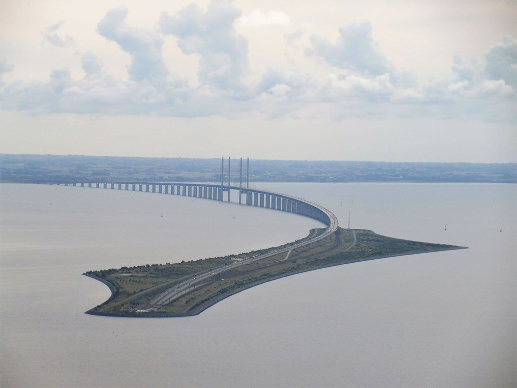
The bridge joins Drogden tunnel on the artificial island of Peberholm (Pepper Islet).
The Danes chose the name to complement the natural island of Saltholm (Salt Islet) just to the north.
Peberholm is a designated nature reserve built from Swedish rock and the soil dredged up during the bridge and tunnel construction, approximately 4 km (2.5 mi) long with an average width of 500 m (1,640 ft). It is 20 m (66 ft) high.
Drogden Tunnel
The connection between Peberholm and the artificial peninsula at Kastrup on Amager island, the nearest populated part of Denmark, is through the 4,050-metre (13,287 ft) long Drogden Tunnel (Drogdentunnelen).
It comprises a 3,510-metre (11,516 ft) immersed tube plus 270-metre (886 ft) entry tunnels at each end.
Öresund Bridge Data
- Country
- Sweden/Denmark
- Region
- North Europe
- Status
- In use
- Official name
- Øresundsbroen, Öresundsbron, Øresundbron
- Location
- Copenhagen, Denmark and Malmö, Sweden
- Contractor
- Hochtief, Skanska, Højgaard & Schultz and Monberg & Thorsen
- Designer(s)
- Jorgen Nissen, Klaus Falbe Hansen, Niels Gimsing and Georg Rotne
- Official website
- oresundsbron.com
- Cost
- 19.6 billion DKK / 25.8 billion SEK ( US $3.1 billion )
- Began
- 1995
- Construction end
- 1999
- Opened
- Jul-01, 2000
- Total length
- 9.9 mi ( 16 km )
- tall
- 669 ft ( 204 m )
- Bridge section length
- 4.9 mi ( 7.8 km )
- Width
- 77 ft ( 23.5 m )
- Deck height
- 187 ft ( 57 m )
- Longest span
- 1608 ft ( 490 m )
- Design type
- Cable-stayed bridge
- Toll
- DKK 390, SEK 460 or € 54
- Crosses
- Øresund strait
View Öresund Bridge on Google Satellite Map
Google satellite maps allow you to see building details more clearly, including natural landscapes such as mountains, rivers, deserts, sea and man-made engineering buildings.
If you are very interested in this engineering building, it is a good idea to click below Google Map icon. We will help you jump to the corresponding location of this building or engineering on Google satellite map.


