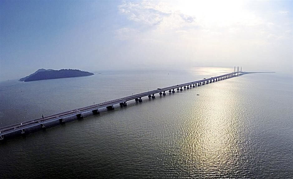
The Sultan Abdul Halim Muadzam Shah Bridge or Second Penang Bridge (Malay: Jambatan Sultan Abdul Halim Muadzam Shah, or Jambatan Kedua Pulau Pinang) is located in Penang Strait in Malaysia.
It connect the area of Seberang Perai on the Malay peninsula with the island of Penang.
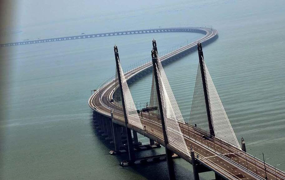
The total length of the bridge is 24 km (15 mi) with length over water at 16.9 km (10.5 mi), making it the longest bridge in Malaysia.It won ICE’s Brunel Medal Award in 2015.
The second Penang bridge was largely funded by a loan from China.It was rm 4.5 billion(about US $1 billion ).
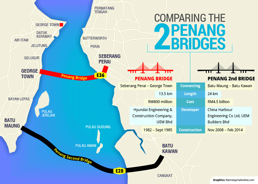
It is the second bridge to link the island to the mainland after the first Penang Bridge.
Construction History
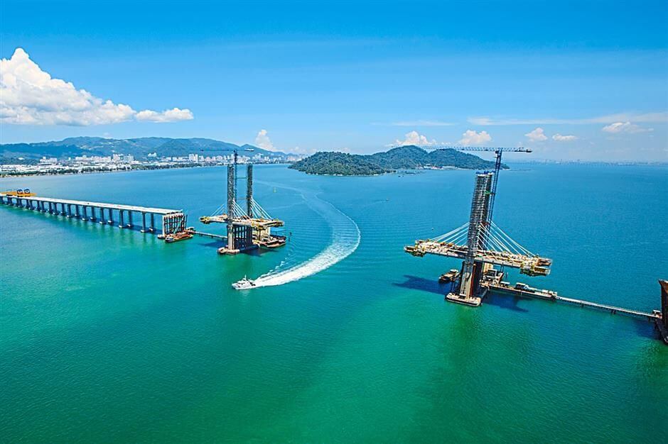
- On 8 November 2008, the construction of the Penang Second Bridge by China Harbour Engineering Co Ltd commenced.
- On 20 April 2013, the final closure of the cable stayed bridge at the main navigational span of the Penang Second Bridge was completed and thus signified the completion of the construction of the bridge and physically connecting Batu Maung on the Island and Batu Kawan on the Mainland.
- The bridge had been planned for completion on 8 November 2013 and to be opened to the public by the end of November.However, the opening day of 8 November 2013 was postponed and the bridge would be opened to traffic on 1 March 2014.
Opening
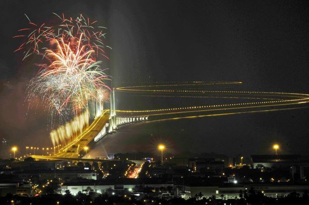
- The opening ceremony of the Penang Second Bridge was held at 20:30 MST on 1 March 2014 and was officially opened by the Malaysian Prime Minister, Najib Tun Razak.
- At midnight on 2 March 2014, the bridge was opened to traffic at 00:01 MST after the official opening ceremony.
Bridge Features
The Sultan Abdul Halim Muadzam Shah Bridge is designed based on the double “S” curvy concept due to the geological reasons.The numerous “S”-like curves along the 24 km stretch are a requirement under the Road Safety Audit.to prevent drivers from getting drowsy, discourage speeding and improve road concentration.
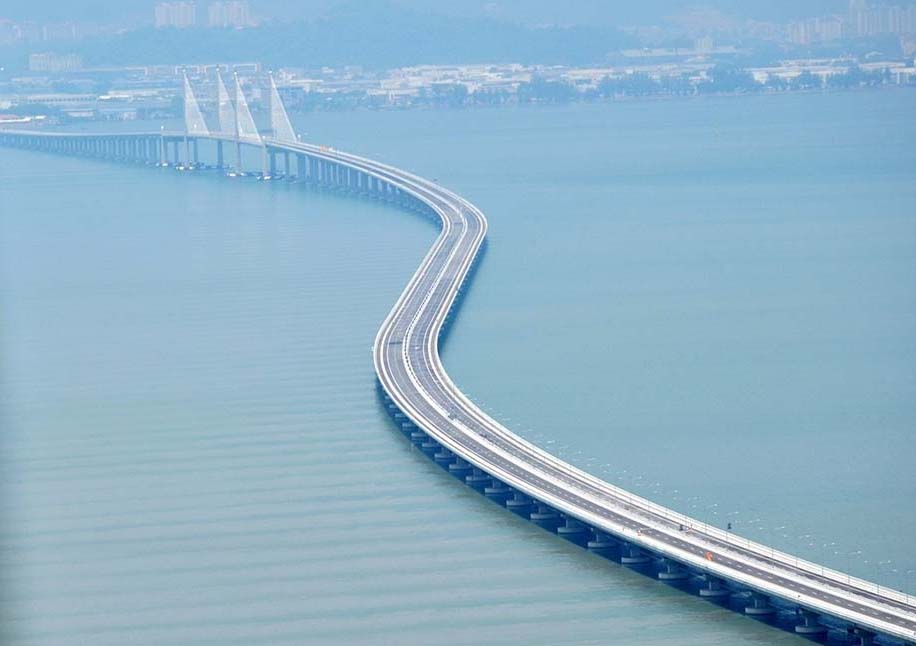
The Sultan Abdul Halim Muadzam Shah Bridge is the longest bridge in the world that installed with High Damping Natural Rubber (HDNR) Bearing.
an effective seismic isolation system that enables the bridge to withstand high intensity earthquakes. The bridge is the first in Malaysia to be installed with seismic expansion joints, which will allow movements during an earthquake.
Second Penang Bridge Causeway Data
- Country
- Malaysia
- Location
- Penang, Malaysia
- Official name
- Jambatan Kedua Pulau Pinang
- Other name
- Sultan Abdul Halim Muadzam Shah Bridge
- Designer(s)
- Government of Malaysia, Malaysian Highway Authority (LLM), China Harbour Engineering Co Ltd(Package 1), UEM Builders Berhad(Package 2)
- Constructed by
- China Harbour Engineering Co Ltd(Package 1), UEM Builders Berhad(Package 2), MAZELE(Package 3A), IJM Construction Sdn Bhd(Package 3B), HRA Teguh Sdn Bhd(Package 3C), SU Citra Bina Sdn Bhd(Package 3D).
- Cost
- rm 4.5 billion(US $1 billion )
- Status
- In use
- Maintained by
- Jambatan Kedua Sdn Bhd (JKSB)
- Began
- Nov-08, 2008
- Construction end
- Apr-20, 2013
- Opened
- Mar-02, 2014
- Total Duration
- 4.5 years
- Length
- 24 km (15 mi)
- Length over water
- 16.9 km (10.5 mi)
- Width
- 30 m (98 ft)
- Deck height
- 30 m (98 ft)
- Longest span
- 250 m (820 ft)
- Design type
- Cable stayed bridge, box girder bridge
- Bridge type
- Cross sea bridge
- Crosses
- Penang Strait, Malaysia
- Road scale
- 6 lanes(4 for cars / 2 for motorcycles)
- Toll
- RM7-10
- Design speed
- 80 km/h (50 mph)
View Second Penang Bridge on Google Satellite Map
Google satellite maps allow you to see building details more clearly, including natural landscapes such as mountains, rivers, deserts, sea and man-made engineering buildings.
If you are very interested in this engineering building, it is a good idea to click below Google Map icon. We will help you jump to the corresponding location of this building or engineering on Google satellite map.


