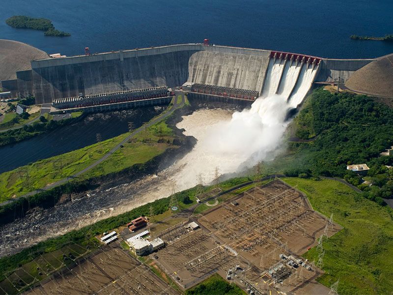
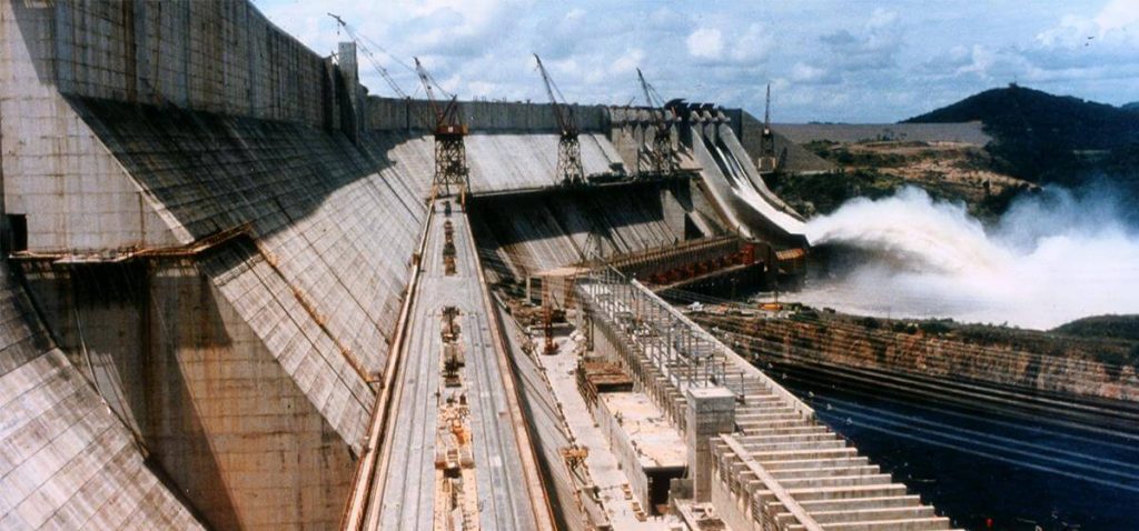
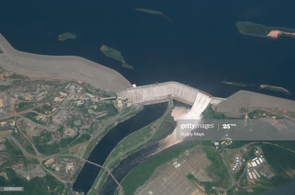
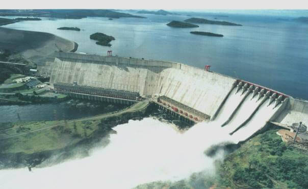
The Simón Bolívar Hydroelectric Plant, also Guri Dam (Spanish: Central Hidroeléctrica Simón Bolívar or Represa de Guri), is a concrete gravity and embankment dam in Bolívar State, Venezuela on the Caroni River built from 1963 to 1969. It is 7,426 metres long and 162 m high. It impounds the large Guri Reservoir (Embalse de Guri)with a surface area of 4,250 square kilometres (1,641 sq mi).
It total cost US $850 million (in 1960).
The Guri Reservoir that supplies the dam is one of the largest on earth. The hydroelectric power station was once the largest worldwide in installed capacity, replacing Grand Coulee HPP, but was surpassed by Brazil and Paraguay’s Itaipu.

Construction History
- 1963: Construction of the Guri hydroelectric power station in the Necuima Canyon begins, located approximately 100 kilometers upstream of the Caroní River’s mouth in Orinoco.
- 1969: A dam with a height of 106 m and a length of 690 m has been built, officially named Central Hidroeléctrica Simón Bolívar (from 1978 to 2000, it was called Central Hidroeléctrica Raúl Leoni). When completed, the total installed capacity of this power station was 1,750 megawatts (MW). It created a reservoir, the largest fresh water area in Venezuela and one of the largest artificial black water lakes. The water level is 215 meters above sea level.
- 1978: The capacity generated by ten turbines has been upgraded to 2065 MW.

- 1976: Construction of the second phase of the project began, constructing a 1300 m long gravity dam, a spillway and a second power station, which contained 10 725 MW turbines.
- November 8, 1986: The second phase of the Guri Dam project opened.
- Since 2000, a refurbishment project has been underway to extend the power plant’s operating period by 30 years. The project will create 5 new runners and main components on Powerhouse II and restore four units on Powerhouse I towards the end of 2007.

Generating failures and blackouts
Due to the government policy implemented in the 1960s to minimize the amount of electricity generated from fossil fuels to export as much oil as possible, 74% of Venezuela’s electricity comes from renewable energy sources, such as hydropower.
As of 2006, the Guri Dam alone provided one-third of Venezuela’s electricity, and part of the electricity generated in Guri was exported to Colombia and Brazil.
2010
This strategy’s risks became apparent in 2010, when the water level was too low due to a prolonged drought to generate enough electricity to meet demand.
In January 2010, the Venezuelan government implemented rolling blackouts in response to low water levels after the dam due to drought.

2016
In April 2016, the water level became low again, and the government announced a power outage for 4 days a day for 40 days, or until the water level stabilized.
The 2016 Easter national holiday has added 3 days, allowing public services and private companies to suspend work for a week.
2019
On March 7, 2019, the Simon Bolivar hydroelectric power station failed and most of Venezuela’s 32 million residents fell into darkness.
Government officials called the power outage a “disruptive behavior,” while experts attribute the failure to aging infrastructure and insufficient maintenance.

Guri Dam Data
- Country
- Venezuela
- Other name
- Simón Bolívar Hydroelectric Plant
- Location
- Necuima Canyon, Bolívar
- Cost
- US $850 million (in 1960)
- Status
- In use
- Constructed by
- atkinson construction
- Began
- 1963
- Opening date
- 1978
- Height
- 162 m (531 ft)
- Length
- 7,426 m (24,364 ft)
- Volume
- Concrete: 6,026,000 m³ (212,806,182 cu ft) Earth: 23,801,000 m³ (840,524,383 cu ft)
- Installed capacity
- 10,235 MW
- Turbines
- Francis Turbines. 10 × 725 MW 4 × 180 MW 3 × 400 MW 3 × 225 MW 1 × 340 MW
- Type of dam
- Gravity/Embankment
- River
- Caroni River
- Reservoi name
- Guri Reservoir
- Total capacity
- 135,000,000,000 m³ (109,446,281 acre ft)
- Reservoir area
- 4,250 k㎡ (1,641 sq mi)
- Spillway type
- Service, controlled crest overflow
View Guri Dam on Google Satellite Map
Google satellite maps allow you to see building details more clearly, including natural landscapes such as mountains, rivers, deserts, sea and man-made engineering buildings.
If you are very interested in this engineering building, it is a good idea to click below Google Map icon. We will help you jump to the corresponding location of this building or engineering on Google satellite map.


