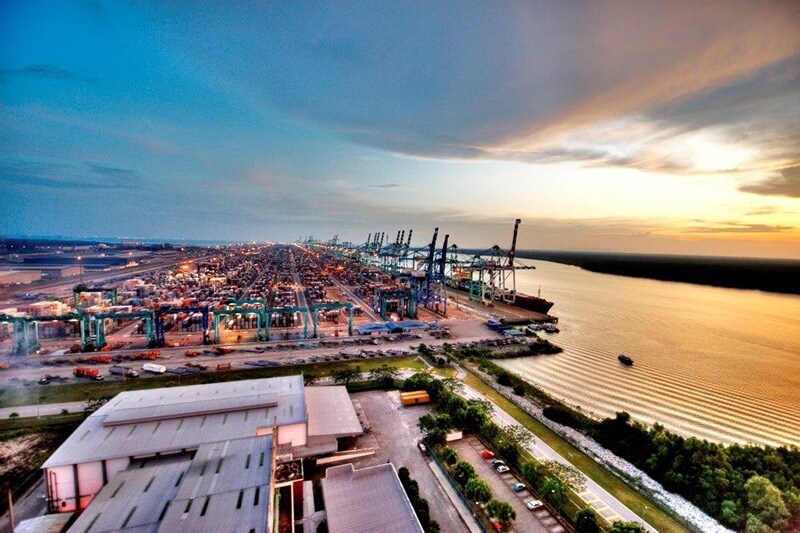
Tanjung pelepas Port is located in Iskandar Puteri, Johor Bahru, Johor, Malaysia. It was built in the northernmost part of Malaysia, at the eastern end of the Strait of Malacca, next to Singapore Port.
Construction of the Port of tanjung pelepas began in the late 1990s. It was put into operation on October 31, 1999. Although it was built later than Singapore Port, it is still one of the important ports in the Strait of Malacca and a participant in the “Maritime Silk Road” in China’s Belt and Road Initiative.
In 2018, the port’s container handling capacity reached 8.9 million TEU.
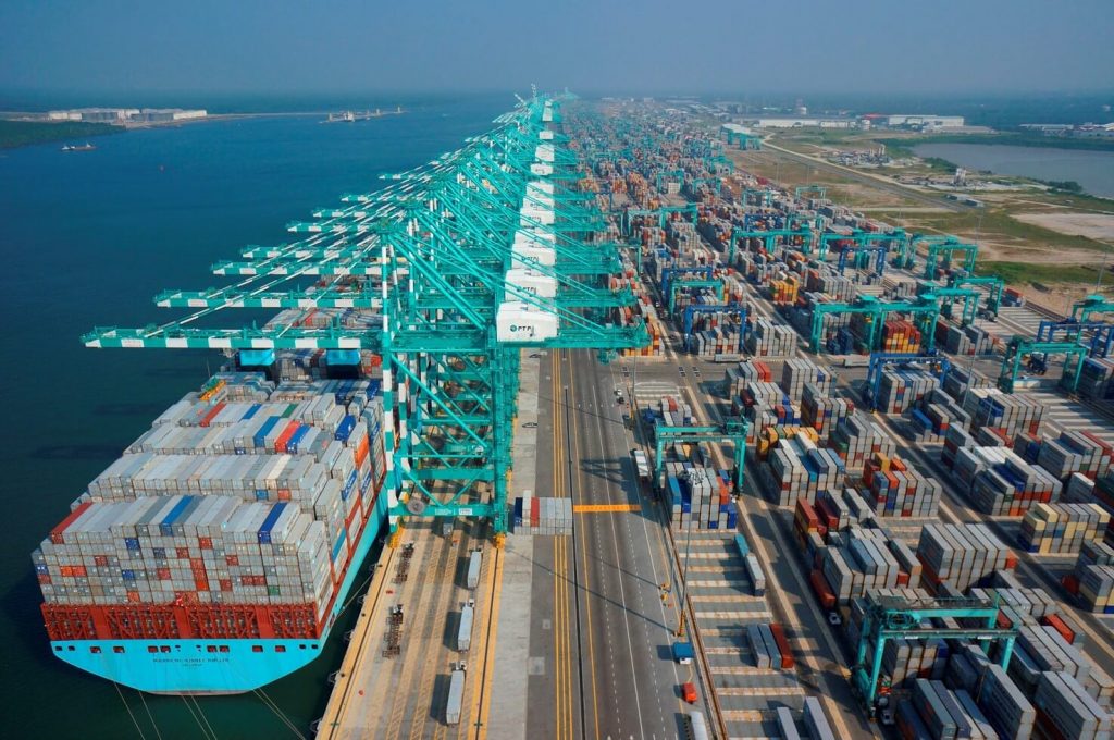
History
- October 31, 1999: The port of Tanjung Pelepas began operations, handling 20,696 TEUs of freight that year.
- 2002: Evergreen Marine Corporation, the world’s second largest shipping company, moved its business from the Port of Singapore to the Port of Tanjung Pelepas, with an annual cargo handling capacity of 2.66 million TEUs.
- August 14, 2003: The dedicated PTP-Haadyai container train service started operating.
- October 28, 2005: CIBA Vision Inc., located in Atlanta, joins as a new tenant in the Pelepas Free Zone.
- August 24, 2008: PTP is the first port in Malaysia to pass the integrated management system certification.
- January 2014: Pan Asia Logistics started operations at PTP, and at the same time all two new berths have been put into operation. This enabled the Tanjung Pelepas port to handle 8.5 million TEUs.
- February 14, 2017: The Karcher Asia Pacific Distribution Center at the Free Port of Tanjung Belapas was officially launched.
- 2018: The port’s container handling capacity reached 8.9 million TEU.
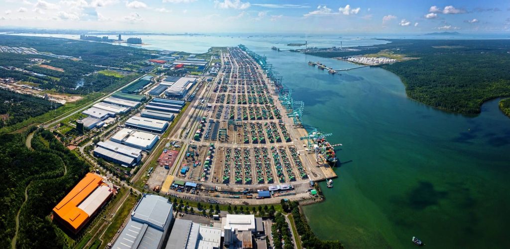
Berth
The current port provides 14 berths with a total length of 4.3 kilometers (6.9 miles). And a 1.2 million square meters (296 acres) container yard, which contains approximately 6.2 million TEU of storage space, 43,874 ground tanks and 5,080 refrigerated container points.
Crane
58 Super Post-Panamax quay cranes serve these berths, 16 EEE cranes (25 outstretched rows), 11 of which have 22 outstretched rows and 40′ double lifting hooks, 30 rows of 22 outstretched and double 20′ Lift.
Today, the port has a total capacity of more than 10.5 million TEUs per year, with 174 rubber-tyred gantry cranes and 390 prime movers operating around the container facility.
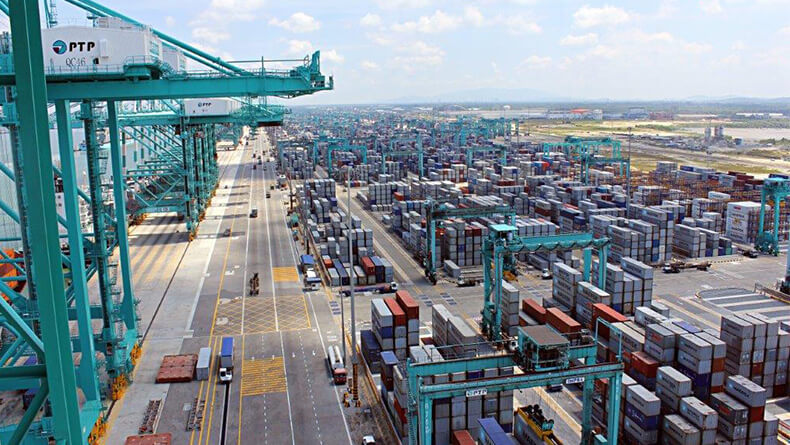
Transportation Facilities
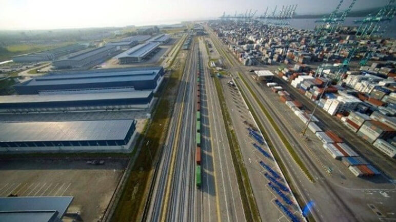
In addition to road connectivity, the port is also connected to the peninsula’s freight rail system through a 4-track railway hub, extending from Johor to the south, to the south of Thailand and to the north.
The port development zone occupies 2,000 acres of port terminals and 1,500 acres of free trade zone.
Railway and multimodal transport
Tanjung Pelepas Port is directly connected to Singapore and Malaysia’s major expressways through a 5.4-km (8.7-mile) direct road and is also connected to southern Thailand through a 4-track railway hub.
Tanjung Pelepas Port is connected to the hinterland by its 31.5 km (50.8 miles) railway.
The port’s 14-lane gate terminal and 6-lane free trade zone can ensure that containers can enter and exit the Tanjung Pelepas port effectively.
Tariff-free zone
The duty-free zone at Tanjung Pelepas Port has been in operation since 1999. The duty-free zone administration appointed by the Malaysian government is responsible for both commercial and industrial duty-free zones.
The Tanjung Pelepas Port tariff-free zone occupies about 1,000 acres adjacent to the port and container terminal.
Approximately 400 acres of land are designated as a free trade zone for logistics, distribution and storage. 600 acres of the free industrial zone for manufacturing.
Tanjung pelepas Port Data
- Country
- Malaysia
- Region
- Southeast Asia
- Status
- In use
- Location
- Iskandar Puteri, Johor Bahru, Johor, Malaysia
- Official website
- lpj.gov.my
- Operator
- Johor Port Authority (JPA)
- Opened
- Oct-31, 1999
- Sea area
- Strait of Malacca
- Port type
- Deepwater port
- Size of port
- 1,800,000 sq.m
- Annual container volume
- 8.9 million TEU (2018)
View Tanjung pelepas Port on Google Satellite Map
Google satellite maps allow you to see building details more clearly, including natural landscapes such as mountains, rivers, deserts, sea and man-made engineering buildings.
If you are very interested in this engineering building, it is a good idea to click below Google Map icon. We will help you jump to the corresponding location of this building or engineering on Google satellite map.


