Rotterdam Port(Dutch:Haven van Rotterdam) is the largest seaport in Europe, located in the city of Rotterdam in the province of South Holland in the Netherlands.
From 1962 until 2004 it was one of the world’s busiest port, now overtaken first by Singapore port and then Shanghai port. In 2018, Rotterdam was the world’s eleventh-largest container port in terms of twenty-foot equivalent units (TEU) handled. In 2017 Rotterdam was the world’s tenth-largest port in terms of annual cargo tonnage.
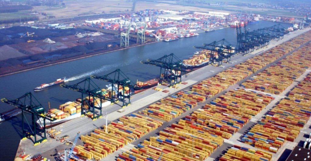
Covering 105 square kilometres (41 sq mi), the port of Rotterdam now stretches over a distance of 40 kilometres (25 mi).
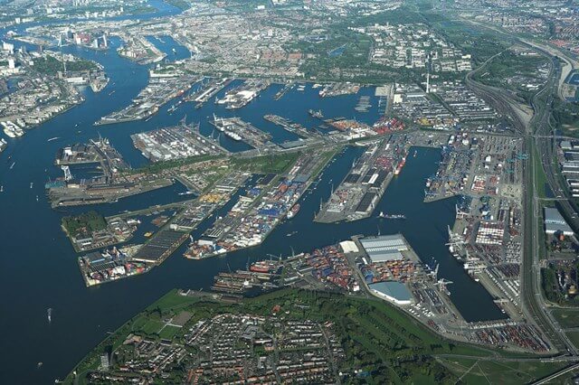
It consists of the city centre’s historic harbour area, including Delfshaven; the Maashaven/Rijnhaven/Feijenoord complex; the harbours around Nieuw-Mathenesse; Waalhaven; Vondelingenplaat; Eemhaven; Botlek; Europoort, situated along the Calandkanaal, Nieuwe Waterweg and Scheur (latter two being continuations of the Nieuwe Maas); and the reclaimed Maasvlakte area, which projects into the North Sea. The Port of Rotterdam is located in the middle of the Rhine-Meuse-Scheldt delta.
Rotterdam has five port concessions (ports) within its boundaries-operated by separate companies under the overall authority of Rotterdam.
Rotterdam consists of five distinct port areas and three distribution parks that facilitate the needs of a hinterland with over 50,000,000 consumers throughout the continent of Europe.
Port history
In the first half of the 19th century the port activities moved from the centre westward towards the North Sea. To improve the connection to the North Sea, the Nieuwe Waterweg (“New Waterway”), a large canal, was designed to connect the Rhine and Meuse rivers to the sea. The Nieuwe Waterweg was designed to be partly dug, then to further deepen the canal bed by the natural flow of the water.
Ultimately however, the last part had to be dug by manual labour as well. Nevertheless, Rotterdam from then on had a direct connection between the sea and harbour areas with sufficient depth. The Nieuwe Waterweg has since been deepened several times. It was ready in 1872 and all sorts of industrial activity formed on the banks of this canal.
After the Second World War, with the economic renaissance in Europe and the establishment of the common market, the Port of Rotterdam developed rapidly due to its superior geographical location.
In 1961, throughput exceeded New York Port (180 million tons) for the first time and became the world’s largest port. Since then, it has maintained its status as the world’s largest port.
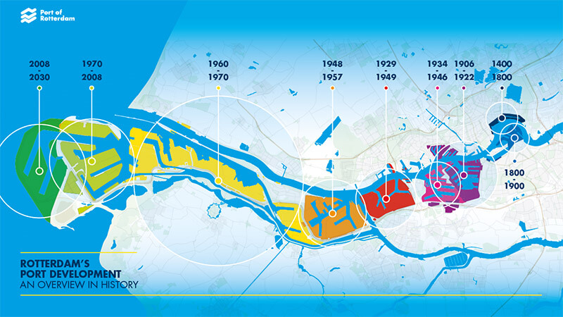
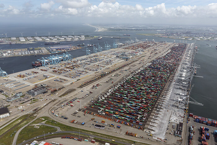
Over the years the port was further developed seaward by building new docks and harbour-basins. Rotterdam’s harbour territory has been enlarged by the construction of the Europoort (gate to Europe) complex along the mouth of the Nieuwe Waterweg.
In the 1970s the port was extended into the sea at the south side of the mouth of the Nieuwe Waterweg by completion of the Maasvlakte (Meuse-plain) which was built in the North Sea near Hoek van Holland.
In 1982, it could handle 2.16 million TEUs, surpassing 1.9 million boxes in New York Port.
Since the 1990s, Ludaidan has begun to implement a new capacity expansion plan to build fifth- and sixth-generation container terminals of 100,000 to 150,000 tons.
In 2000, the throughput reached 320 million tons, a record high. In Rotterdam, more than 30,000 ships entered the port each year, and more than 120,000 inland vessels sailed to various European countries. The Port of Rotterdam has an advanced ECT container terminal, with an annual transportation volume of 6.4 million TEUs.
In the past five years the industrialised skyline has been changed by the addition of large numbers of wind turbines taking advantage of the exposed coastal conditions.
The construction of a second Maasvlakte received initial political approval in 2004, but was stopped by the Raad van State (the Dutch Council of State, which advises the government and parliament on legislation and governance) in 2005, because the plans did not take enough account of environmental issues. On 10 October 2006,
By 2010, container throughput capacity will reach 6 million boxes to ensure the status of Europe’s largest container transportation center.
Status (as of 2005)
The employed population of Rotterdam Port is more than 70,000 people, accounting for 1.4% of the national employment population, freight volume accounts for 78% of the country, and the total output value reaches 12 billion Dutch rupiah, accounting for about 2.5% of the Dutch gross national product.
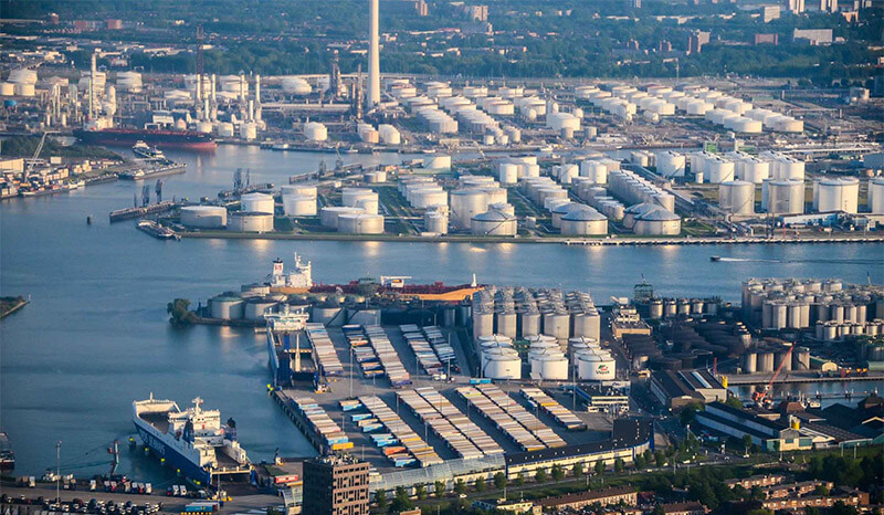
The Rotterdam port area is the main body of the city. It covers an area of more than 100 square kilometers, the port water area is 277.1 square kilometers, and the water depth is 6.7 to 21 meters. 544,000 tons of super tanker.
The total length of the sea-ship terminal is 56 kilometers, and the total length of the river ship terminal is 33.6 kilometers. Specialized handling of general cargo, oil, coal, ore, grain, chemicals, bulk, and containers is implemented. The annual throughput is about 300 million tons.
The main lines of port cargo transportation, the Rhine River, highways, port railways, are connected to domestic and foreign transportation networks. In addition to the transshipment of the Laihe River, the crude oil entering the port is also laid with a transportation oil pipeline that leads directly to Amsterdam, Germany, and Belgium. Bulk transit freight accounts for 85% of the total freight, of which crude oil and petroleum products account for 70%, and the rest is ore, coal, grain, fertilizer, etc. The main target countries for imports and exports are Germany, Britain, France, Italy and other EU countries.
Port facilities
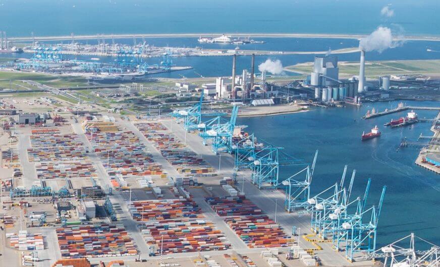
The EECV-quay of the port has a draft of 24 metres (78 feet).
This made it one of only two available mooring locations for one of the largest bulk cargo ships in the world, the iron ore bulk carrier MS Berge Stahl when it is fully loaded, along with the Terminal of Ponta da Madeira in Brazil, until the opening of a new deep-water iron ore wharf at Caofeidian in China in 2011.
The ship’s draft of 23 meters (75 feet) leaves only 1 metre (3 feet) of under keel clearance, therefore it can only dock in a restricted tidal window. Such ships must travel in the Eurogeul.
Intelligent port
Robotic container operations
Much of the container loading and stacking in the port is handled by autonomous robotic cranes and computer controlled chariots. The ECT pioneered the development of terminal automation. At the Delta terminal, the chariots—or automated guided vehicles (AGV)—are unmanned and each carries one container.
The chariots navigate their own way around the terminal with the help of a magnetic grid built into the terminal tarmac. Once a container is loaded onto an AGV, it is identified by infrared “eyes” and delivered to its designated place within the terminal. This terminal is also named “the ghost terminal”.
Unmanned Automated Stacking Cranes (ASC) take containers to/from the AGVs and store them in the stacking yard. The newer Euromax terminal implements an evolution of this design that eliminates the use of straddle carriers for the land-side operations.
Smart Technology
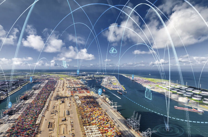
The Port Authority at the Port of Rotterdam uses the Internet of Things, a cloud-based platform, to collect and process data from sensors around the port. In May 2019, the port sent Container 42 out on a two-year data-collecting mission .
Rotterdam Port Data
- Country
- Netherlands
- Official name
- Haven van Rotterdam
- Location
- Rotterdam, South Holland
- Operator(s)
- Port of Rotterdam Authority
- Year of opening
- 14th century
- Industrialization date
- First half of the 19th century
- Status
- In use
- Size of port
- 4,810 ha / 11,900 acres (2018)
- Port type
- Deepwater seaport, Riverport
- Features
- Smart port, Natural port, Artificial port
- Region
- Western Europe
- Sea area
- North Sea
- Annual container volume
- 14.5 million TEU (2018)
- Annual cargo tonnage
- 469 million tons (2018)
View Rotterdam Port on Google Satellite Map
Google satellite maps allow you to see building details more clearly, including natural landscapes such as mountains, rivers, deserts, sea and man-made engineering buildings.
If you are very interested in this engineering building, it is a good idea to click below Google Map icon. We will help you jump to the corresponding location of this building or engineering on Google satellite map.


