Itaipu Dam (Portuguese:Barragem de Itaipu) is the second largest power generation dam in the world (as of 2020)
The Itaipu Dam was built by Brazil and Paraguay on the Parana River. It is located in the river section between the border of Brazil and Paraguay.
It is 14 kilometers away from the Friendship Bridge, which connects Brazil ’s Iguazu City and Paraguay ’s Este City.
It total cost about US $19.6 billion.
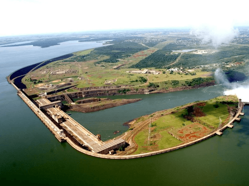
Construction history
In February 1971,Started design and research of hydropower project.
In January 1975,Construction began.
On October 14, 1978, the Parana River was diverted,Construction of the main river dam started.
Start operations
On May 5, 1984, the first generation unit started operation at Itaipu. The installation speed of the first 18 devices is 2 to 3 per year; the last two of them started in 1991.
The entire construction period took about 18 years.
Generating station and dam
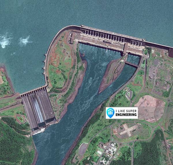
The total length of the dam is 7,235 metres (23,737 ft). The crest elevation is 225 metres (738 ft).
The dam is 196 metres (643 ft) high, equivalent to a 65-story building.
It consumed 12.3 million cubic meters of concrete, while the iron and steel employed would permit the construction of 380 Eiffel Towers.
The spillway has a length of 483 metres (1,585 ft).
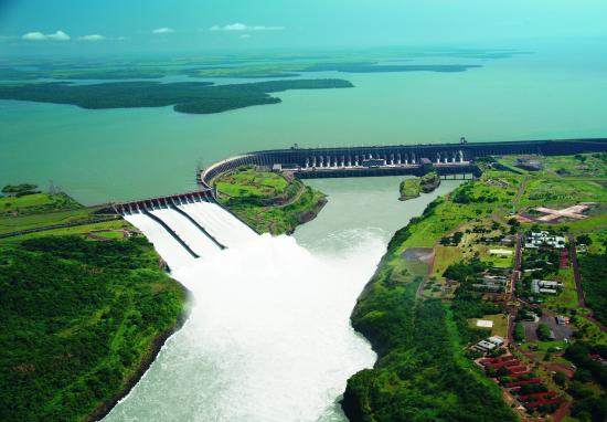
The maximum flow of Itaipu’s fourteen segmented spillways is 62.2 thousand cubic metres per second (2.20×10⁶ cu ft/s), into three skislope formed canals. It is equivalent to 40 times the average flow of the nearby natural Iguaçu Falls.
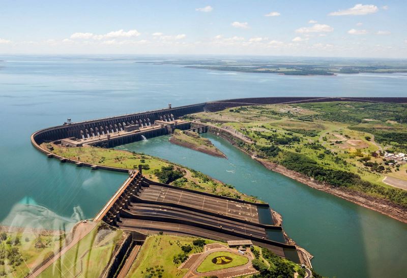
Itaipu is actually four dams joined together – from the far left, an earth fill dam, a rock fill dam, a concrete buttress main dam, and a concrete wing dam to the right.
Itaipu Reservoir
The Itaipu reservoir, with a flooded area of 1,350 k㎡, is the seventh largest in Brazil, but holds the best coefficient of water utilization for electricity generation of all the large Brazilian reservoirs.
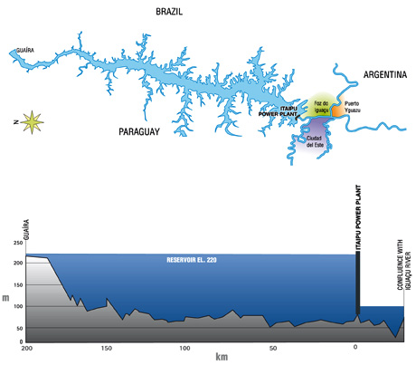
The production coefficient of water utilization at Itaipu is 10.4 MW per km², (i.e., each 0.1 km² of flooded area can generate 1 MW).
Itaipu Dam Data
- Country
- Brazil/Paraguay
- Location
- Foz do Iguaçu,Hernandarias
- Cost
- US $19.6 billion
- Owner(s)
- Brazilian Government / Paraguay Government
- Official name
- Barragem de Itaipu
- Operator(s)
- Itaipu Binacional
- Status
- In use
- Began
- Jan, 1975
- Opening date
- May-05, 1984
- Total Duration
- 18 years
- Height
- 643 ft ( 196 m )
- Length
- 25,981 ft ( 7,919 m )
- Building Volume
- 12,300,000 m³ ( 434,370,000 cu ft )
- Installed capacity
- 14,000 MW
- Turbines
- 20×700 MW
- Type of dam
- Combination hollow gravity dam
- river
- Paraná River
- Reservoi name
- Itaipu Reservoir
- Reservoir area
- 1,350 k㎡ (520 sq mi)
- Original water level
- 104 m
- Current water level
- 220 m
- Reservoi Maximum length
- 170 km (110 mi)
- Total capacity
- 29 km³ (23,510,000 acre ft)
View Itaipu Dam on Google Satellite Map
Google satellite maps allow you to see building details more clearly, including natural landscapes such as mountains, rivers, deserts, sea and man-made engineering buildings.
If you are very interested in this engineering building, it is a good idea to click below Google Map icon. We will help you jump to the corresponding location of this building or engineering on Google satellite map.


[…] Itaipu Dam […]