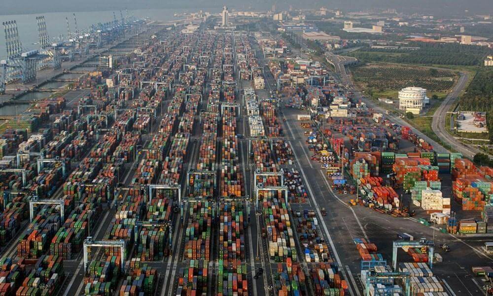
Port Klang (Malay: Pelabuhan Klang) is located in Klang, Selangor, Malaysia. It was formerly called Swettenham Port. It is located about 6 kilometers (3.7 miles) southwest of Klang Town and 38 kilometers (24 miles) southwest of Kuala Lumpur.
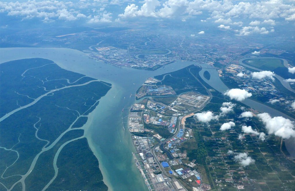
Port Klang was built on the north bank of the Strait of Malacca. The Strait of Malacca is the most important transportation route in Southeast Asia and East Asia, and has important strategic significance.
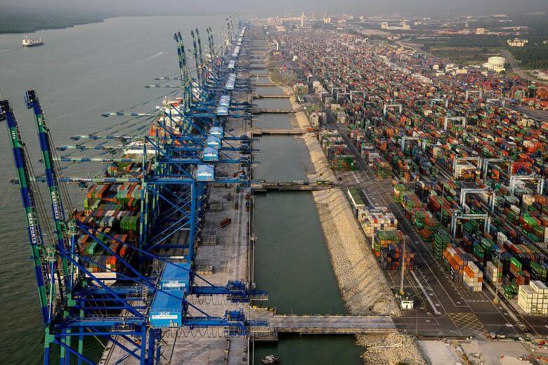
In 2012, Port Klang was the 11th busiest container port in the world, and was later surpassed by China’s rising ports. In 2018, Port Klang’s container handling capacity reached 12.3 million TEU.
History
British rule
- 1890s: The railway from Kuala Lumpur to Klang was opened, and tin ore from Kuala Lumpur was continuously transported to Klang, which gradually increased the scale of the Port of Klang. The old port on the Klang River could not cope with the demand for sea transportation. Construction of the new port begins.
- September 15, 1901: The new port was officially opened, called Swettenham Port. The location of the new port is the mouth of the Klang River.
- 1914: Due to the growth of trade, two new berths and some port facilities were built.
Between World War I and World War II, the port experienced tremendous growth and expansion.
- 1940: The annual tonnage of Swettenham port rises to 550,000 tons.
- 1954: Most of the port facilities damaged during the war were rebuilt, and the port area continued to expand southward.
After Malaysia’s independence
- July 1, 1963: The Malaysian government established the Swettenham Port Authority, named the Klang Malayan Railway Authority and took over the administrative affairs of the Port Klang.
- 1970s: New deep-water berths were built in the port of Swettenham, including terminals suitable for handling containers and conventional cargo.
- November 1972: Malaysian Prime Minister Tun Abdul Razak announced the opening of the container terminal.
- Opened in May 1974: The construction of seven bulk cargo berths began and was completed in 1983.
- October 1982: Construction of the North Port’s liquid bulk terminal was completed.
After privatization
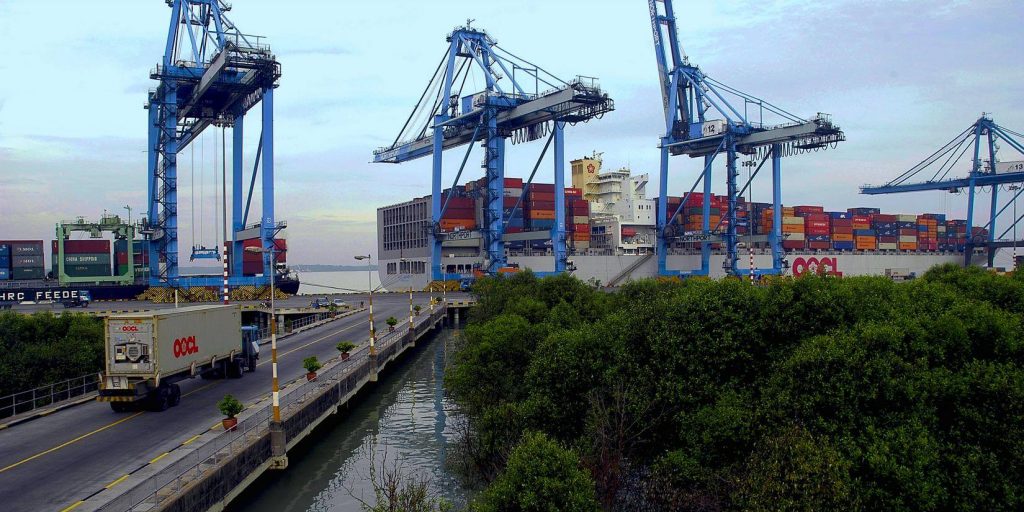
- March 17, 1986: The container terminal facility operated by the Port Klang Authority was privatized into the Klang Container Terminal Co., Ltd. as part of the government’s privatization. The authority holds a 20% stake in the new company.
- January 1988: Construction began on a new 800-foot (240 m) berth to replace the immediate development of Westport.
- 1993: The Malaysian government decided to develop Port Klang into a national shipping center. Since then, Port Klang has developed and grown and has established trade links with more than 120 countries and trade with more than 500 ports around the world.
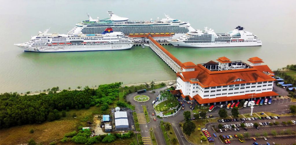
- December 1995: Westport’s Boustead Cruise Center (BCC) opened on Pulau Lumut island. It is a passenger port. It was developed by a private company.
- 2005: The total capacity of the port was 109.7 million tons of cargo.
- 2011: The total cargo handling capacity of Port Klang was 193 million tons.
- 2018: Port Klang’s container handling capacity reached 12.3 million TEU.
Port structure
The Port of Klang actually includes 3 different port areas.
- South Port: The port nearest to Port Klang is called South Port, which is the old port area of Port Klang.
- North Port: North port Wharve liquid bulk terminal built in 1982.
- Westport: The newly developed Westport, Boustead Cruise Center (BCC), is located on Indah Island near the coast of Port Klang. It is a passenger port.
Port Klang Data
- Country
- Malaysia
- Region
- Southeast Asia
- Status
- In use
- Official name
- Pelabuhan Klang
- Other name
- ڤلابوهن کلڠ
- Location
- Klang, Selangor, Malaysia
- Owner
- Klang Municipal Council (MPK)
- Official website
- pka.gov.my
- Operator
- Port Klang Authority
- Began
- 1890
- Opened
- Sep-15, 1901
- Sea area
- Strait of Malacca
- Water area
- 573 km2 (221 sq mi)
- Annual container volume
- 12.3 million TEU (2018)
- Annual cargo tonnage
- 193 million tons (2011)
View Port Klang on Google Satellite Map
Google satellite maps allow you to see building details more clearly, including natural landscapes such as mountains, rivers, deserts, sea and man-made engineering buildings.
If you are very interested in this engineering building, it is a good idea to click below Google Map icon. We will help you jump to the corresponding location of this building or engineering on Google satellite map.


