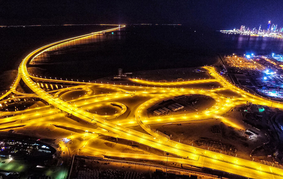
Sheikh Jaber Al-Ahmad Al-Sabah Causeway (Arabic: جسر الشيخ جابر الأحمد الصباح) is located in Kuwait in the Middle East. It is a super sea-crossing bridge built in the Gulf of Kuwait. It connects Kuwait City and Madinat al-Hareer (مدينة الحرير).
Although it has Causeway in its name, it is a real bridge. The total length of the bridge project is 30.1 mi (48.5 km ). Construction began on November 3, 2013 and opened on May 1, 2019. The construction period is about 4 years. A total of 903 million Kuwaiti dinars (US $3 billion) were spent.
It is named after Kuwaiti President Emir who was in power during the Gulf War to commemorate his contribution to Kuwait.
History
- November 3, 2013: Construction of the Kuwait Gulf Bridge project began.
- May 1, 2019: Sheikh Jaber Al-Ahmad Al-Sabah Causeway opens, one of the largest construction projects in Kuwait’s history.
Building technical parameters
The total length of the bridge project is 30.1 mi (48.5 km), and a total of 903 million Kuwaiti dinars (US $3 billion) were spent.
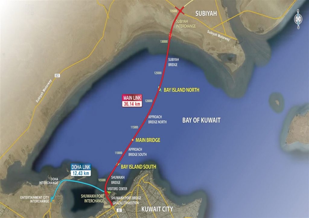
It is divided into 2 parts: the main bridge and the Jaber link Doha Bridge.
Main bridge
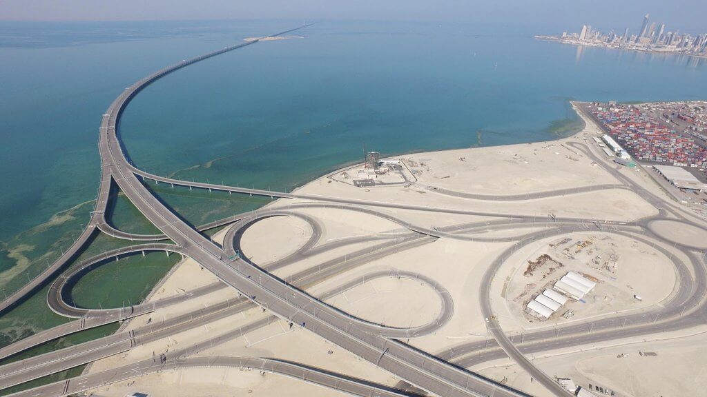
- The length of the main bridge is 22.5 mi (36.1 km), and the length on the water is 16.7 mi (26.8 km). The land length is close to 10km, which are the 3km line section of Shuwaikh and the 6km land bridge project in Subiya area.
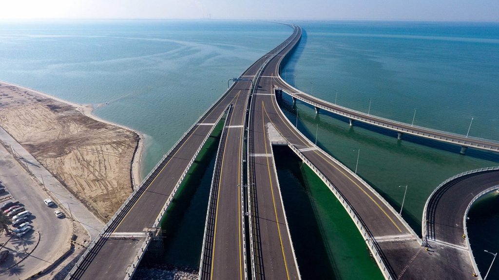
- It consists of 2 bridges built side by side, with 3 lanes and 1 safety lane on each bridge. The width of a single bridge is 56 ft (17 m). It cost 738 million Kuwaiti dinars (US $2.4 billion ).
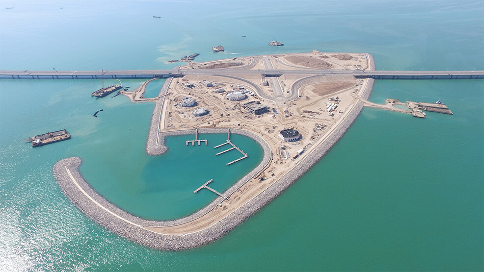
South and North Artificial Island
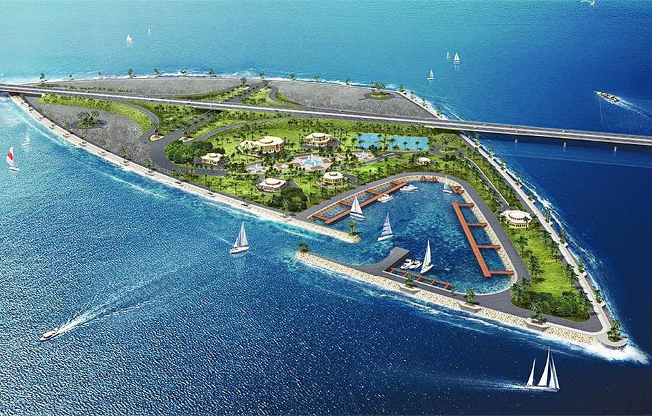
It also includes the construction of two artificial islands, one for 300,000 m² and the other for 600,000 m², including the construction of transportation services, emergency services, monitoring and maintenance of bridges, gas stations and docks.
Main channel bridge
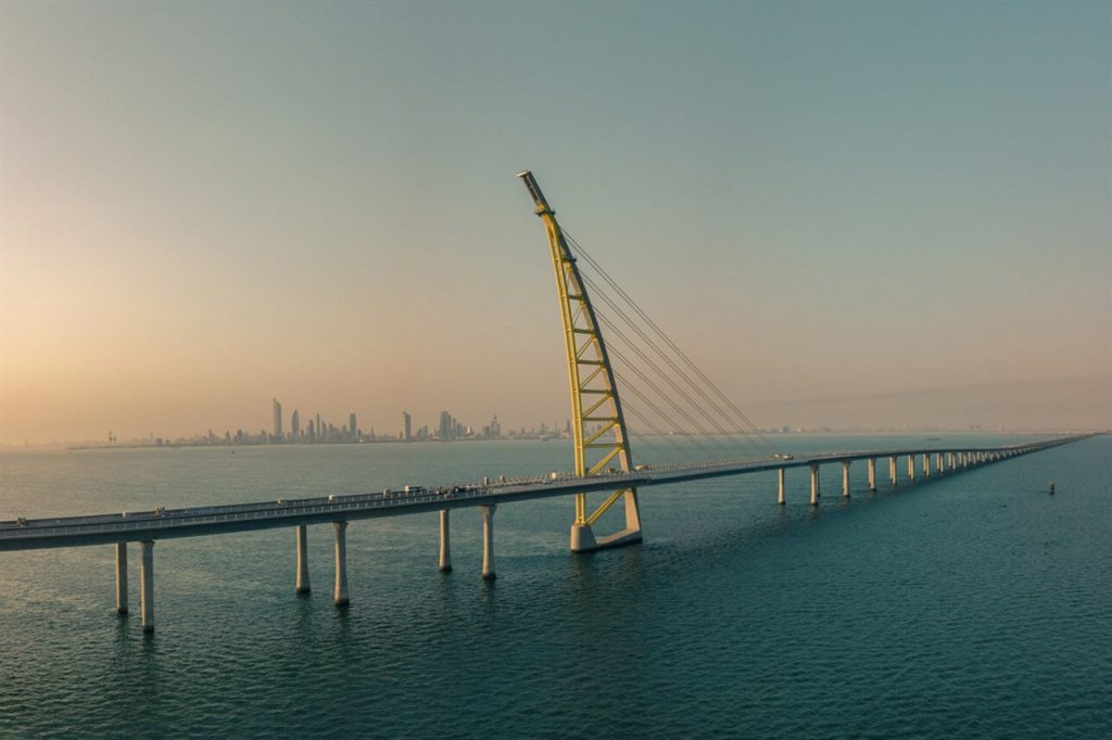
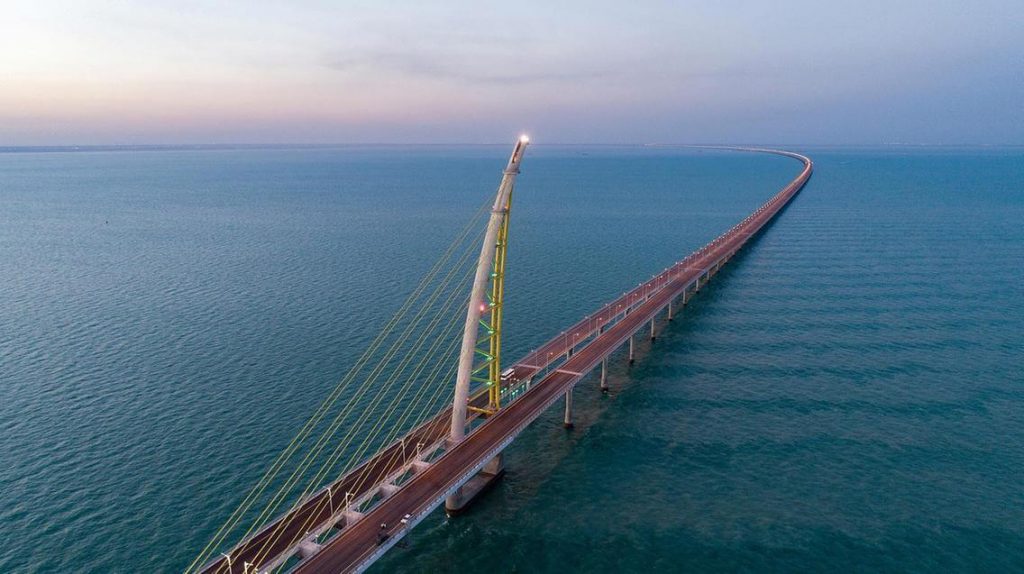
- The span of the main channel bridge is 581 ft (177 m), and the tower is about 495 ft (151 m) high, the same height as the famous Kuwait Tower. The main navigation bridge is 75 ft (23 m) high and has a 394 ft (120 m) navigable port for ships to enter and exit the Doha Port of Kuwait.
- The prominent feature of the design of the main channel bridge is the iconic tower of the cable-stayed bridge, which is built using mixed concrete and steel trusses. It is inspired by traditional sailing boats, which is the traditional and historical theme of Kuwait.
Jaber link Doha Bridge
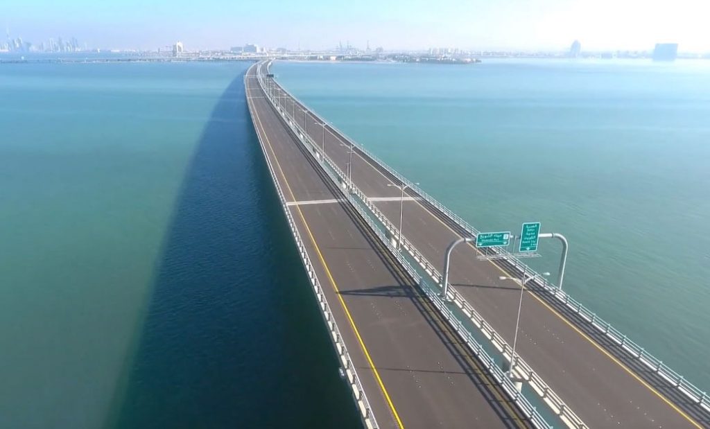
- The length of the Jaber link Doha Bridge is 7.7 mi (12.4 km ). It connects to the Doha area westward from Freeport.
- It includes a 2.9 mi (4.7 km) kilometer long road (Doha link), including five 2379 ft (725 m) overpasses and a 4.8 mi (7.7 km) long sea bridge. It has 6 two-way lanes and 2 safety lanes, and the cost is 165 million Kuwaiti dinars (US $540 million).
The causeway is mainly concrete piles, piers and superstructures. However, the superstructure deck of the main bridge is mainly steel, with waterproof membrane and asphalt layer on it.
The bridge integrates a supervisory control and data acquisition (SCADA) system that tracks activities on the bridge. It has about 600 cameras to observe traffic conditions and any emergency situations.
This project was designed by the French company Systra, and the construction party was the South Korean Hyundai Engineering Construction Company and the Kuwait Joint Contracting Engineering Company. The service life of the bridge is 100 years.
Causeway and Silk City
Madinat al-Hareer is also called Silk City, because it is a product that echoes China’s “One Belt, One Road” plan and is part of the Maritime Silk Road, so it is called Silk City.
Silk City plans to invest 25 billion Kuwaiti Dinars (132 billion USD) with an area of 250 km². It will have a duty-free zone, a large port, a large modern international airport, an Olympic stadium and tall buildings more than Burj Khalifa in Dubai.
Kuwait has also signed a cooperation agreement with China for the development of the Silk City and its economic belt. The City of Silk will use Chinese as well as Arabic and English as the city’s business languages.
The Sheikh Jaber Al-Ahmad Al-Sabah Causeway reduced the distance between the capital of Kuwait and the Silk City from 104 kilometers to 36 kilometers, and the travel time between the two cities has been reduced from the current 90 minutes to less than 30 minutes.
Both the Causeway and Silk City are part of Kuwait’s National Development Plan 2035.
Sheikh Jaber Al-Ahmad Al-Sabah Causeway Data
- Country
- Kuwait
- Region
- Western Asia
- Status
- In use
- Official name
- جسر الشيخ جابر الأحمد الصباح
- Other name
- Sheikh Jaber Al-Ahmad Bridge, Kuwait Bay Bridge, Jaber link Doha Bridge
- Location
- Kuwait City and Silk City, Kuwait
- Owner
- Ministry of Public Works
- Contractor
- Hyundai Engineering & Construction
- Designer
- Systra
- Cost
- 903 million Kuwaiti dinars ( US $3 billion )
- Design life
- 100
- Began
- Nov-03, 2013
- Opened
- May-01, 2019
- Total Duration
- 4
- Total length
- 30.1 mi ( 48.5 km )
- Tall (tower)
- 495 ft ( 151 m )
- Length over water
- 21.7 mi ( 34.9 km )
- Bridge section length
- 23 mi ( 37 km )
- Width
- 56*2 ft ( 17*2 m )
- Deck height
- 75 ft ( 23 m )
- Longest span
- 581 ft ( 177 m )
- Design type
- Beam bridge
- Road scale
- 6 lanes
- Crosses
- Kuwait Gulf
View Sheikh Jaber Al-Ahmad Al-Sabah Causeway on Google Satellite Map
Google satellite maps allow you to see building details more clearly, including natural landscapes such as mountains, rivers, deserts, sea and man-made engineering buildings.
If you are very interested in this engineering building, it is a good idea to click below Google Map icon. We will help you jump to the corresponding location of this building or engineering on Google satellite map.


