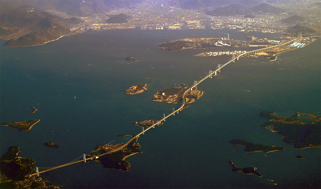
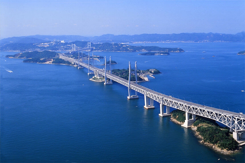
The Great Seto Bridge (瀬戸大橋, Seto Ōhashi) is a series of double deck bridges connecting Okayama and Kagawa prefectures in Japan across a series of five small islands in the Seto Inland Sea.
Built over the period 1978–88, it is one of the three routes of the Honshū–Shikoku Bridge Project connecting Honshū and Shikoku islands, and the only one with railroad connections included.
With 13.1 kilometers (8.1 mi) two-tiered bridge, it ranks as one of the world’s longest two-tiered bridge system.
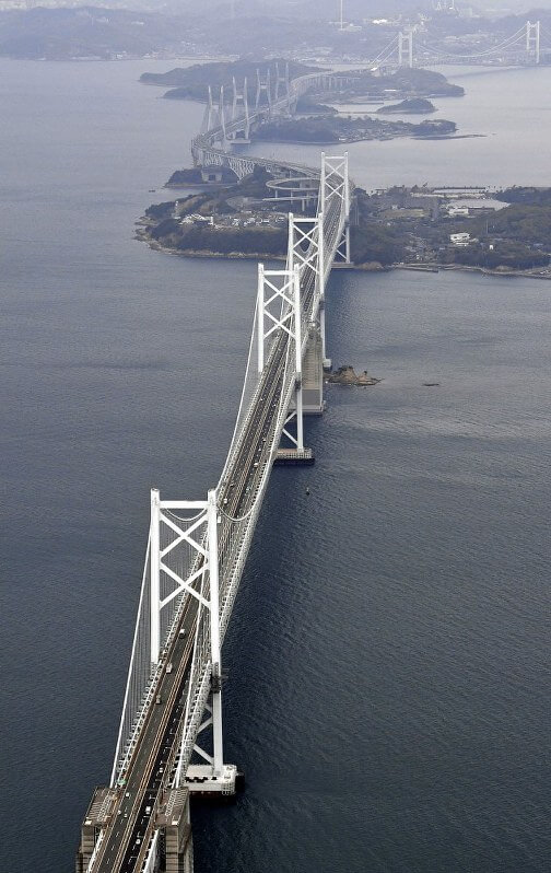
Crossing the bridge takes about 20 minutes by car or train.
The ferry crossing before the bridge was built took about an hour.
The bridges carry two lanes of highway traffic in each direction (Seto-Chūō Expressway) on the upper deck and one railway track in each direction (Seto-Ōhashi Line) on the lower deck.
The lower deck was designed to accommodate Shinkansen services sharing with the Seto-Ōhashi Line on dual gauge track similar to the Seikan Tunnel.
Construction parameters
The Seto Bridge has two upper and lower decks, with cars on the upper deck. The speed is designed to be 100 kilometers per hour. It has four parallel lanes and a daily passing capacity of 48,000 vehicles.
The lower level is a double-track railway with a designed speed of 160 kilometers per hour.
The project took ten years to complete at a cost of US$7 billion; 3.646 million cubic meters (128.8 million cubic feet) of concrete and 705,000 tons of steel were used in construction. A total of 70 steel rails, 290,600 kilometers of steel cables were used .
Its two bridge towers are 194 meters high and 1100 meters in span. The diameter of the steel cable used is 1.07 meters and the length is about 1780 meters. They can withstand a 9-aligned pulling force.
The axis is 65 meters above the water surface, and the 50mm giant wheel can be unimpeded under the bridge.
Taking into account natural disasters and ship collisions, according to the design, the bridge can withstand a magnitude 8.5 earthquake and a wind speed of 60 meters per second.
In order to prevent the ship from colliding with the pier and causing mutual damage, the outer layer of the pier replaces the material that is not soft or hard and resistant to seawater corrosion.
History
In 1955, after 171 lives were lost when a ferry wrecked in dense fog off the coast of Takamatsu, a safer crossing was deemed necessary. By 1959, meetings were held to promote building the bridge. Scientists began investigations shortly after, and in 1970, the Honshu-Shikoku Bridge Construction Authority was inaugurated. However, work was postponed for five years by the “oil shock” of 1973; once the Environment Assessment Report was published in 1978, construction got underway.
Railway Group
The silver Seto Bridge is 37.3 kilometers away and the sea part is 13.1 kilometers. It consists of 3 cable bridges, 2 cable-stayed bridges and 1 truss bridge.
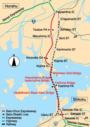
In order not to affect the navigation and landscape of the ship, the pier is basically built on 5 small islands in the sea to form 6 connected bridges, they are:
1. Shimotsui-Seto Bridge
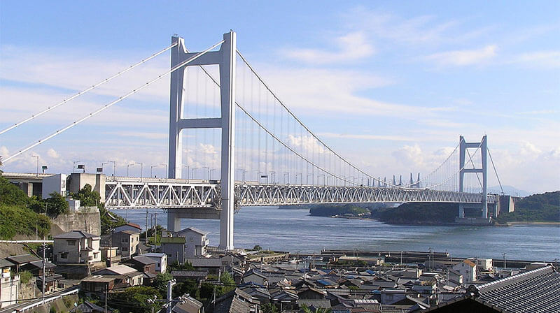
The Shimotsui-Seto Bridge (下津井瀬戸大橋, Shimotsui Seto Ō-hashi) is a double-decked suspension bridge with a center span of 940 meters (3,080 ft) and a total length of 1,400 meters (4,600 ft) which connects Honshū with the island of Hitsuishijima. It is the 22nd largest suspension bridge in the world. It is the northernmost bridge of the Seto-Chuo Expressway.
2. Hitsuishijima Bridge
The Hitsuishijima Bridge ( 櫃石島橋, Hitsuishijima-kyō) is a double-decked cable-stayed bridge with a center span of 420 meters (1,380 ft) and a total length of 790 meters (2,590 ft). It is immediately north of the identical Iwakurojima Bridge.
Its shape is the same as Iwakuro jima Bridge.
3. Iwakuro jima Bridge
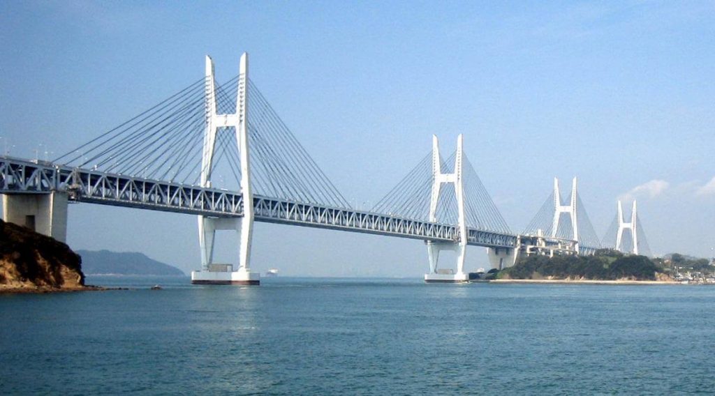
The Iwakuro jima Bridge (岩黒島橋, Iwakurojima-kyō) is a double-decked cable-stayed bridge with a center span of 420 meters (1,380 ft) and a total length of 790 meters (2,590 ft). It is immediately south of the identical Hitsuishijima Bridge.
4. Yoshima Bridge
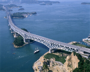
The Yoshima Bridge (与島橋, Yoshima-kyō) is a continuous double-decked truss bridge with a main span of 246 meters (807 ft) and a total of five spans with a length of 847 meters (2,779 ft). It is immediately south of the Hitsuishijima and Iwakurojima Bridges.
5. Kita Bisan-Seto Bridge
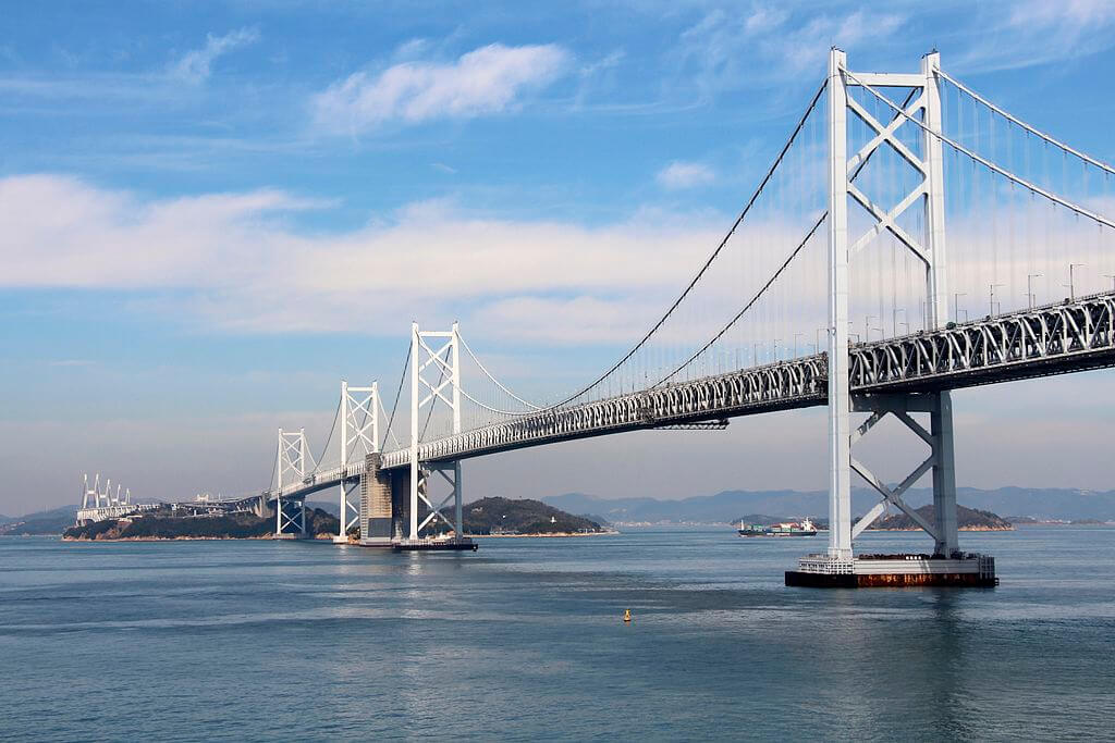
The Kita Bisan-Seto Bridge ( 北備讃瀬戸大橋, Kita Bisan Seto Ō-hashi) is a double-decked suspension bridge with two sections linked by a common anchorage between them. The center span is 990 meters (3,248 ft) and the total length is 1,538 m (5,046 ft). It is the 19th largest suspension bridge in the world. The nearly identical Minami Bisan Seto Bridge is located immediately to the south
6. Minami Bisan-Seto Bridge
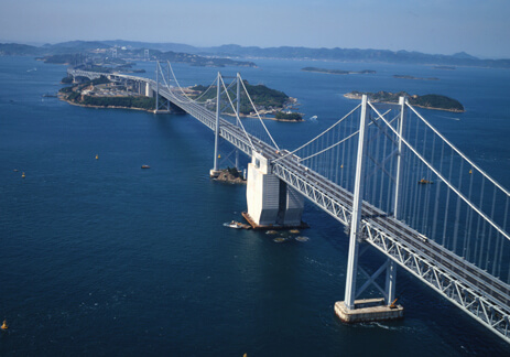
The Minami Bisan-Seto Bridge (南備讃瀬戸大橋, Minami Bisan Seto Ōhashi) is a double-decked suspension bridge with a center span of 1,100 meters (3,609 ft) and a total length of 1,648 m (5,407 ft). It is the 13th longest suspension bridge span in the world. It is the southernmost part of the Great Seto Bridge. The roadway of the bridge is 93 meters (305 ft) above sea level.
influences
On April 10, 1988, the Seto Bridge, the largest project in Japan at that time, opened to traffic and connected the four islands by rail for the first time.
The completion of the bridge basically facilitated cross-strait traffic and added a man-made landscape to the Seto waters, adding to the prestigious tourist destination of western Japan.
People can quickly take the train from Hokkaido as cold as Siberia through Honshu, to the subtropical climate of Kyushu port and the incense temples on the southern island of Shikoku, and enter the new bridge through the Seto Inland Sea, one of the most beautiful waters in the world.
Great Seto Bridge Data
- Country
- Japan
- Location
- Between Honshū and Shikoku
- Official name
- 瀬戸大橋,Seto Ōhashi
- Cost
- US $7 billion
- Status
- In use
- Maintained by
- Honshu–Shikoku Bridge Authority
- Began
- Oct-10, 1978
- Opening date
- Apr-10, 1988/dd>
- Total Duration
- 9 years 6 months
- Length
- 37 km (23 mi)
- Bridge section length
- 13.1 km (8.1 mi)
- Design type
- Double-decked bridge system
- Bridge type
- Cross sea bridge
- Crosses
- Seto Inland Sea
- Road scale
- 4 lanes (upper), 2 rail lines (lower).
View Great Seto Bridge on Google Satellite Map
Google satellite maps allow you to see building details more clearly, including natural landscapes such as mountains, rivers, deserts, sea and man-made engineering buildings.
If you are very interested in this engineering building, it is a good idea to click below Google Map icon. We will help you jump to the corresponding location of this building or engineering on Google satellite map.


