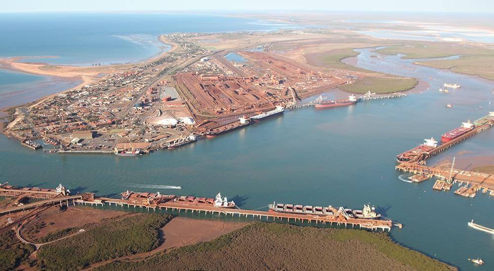
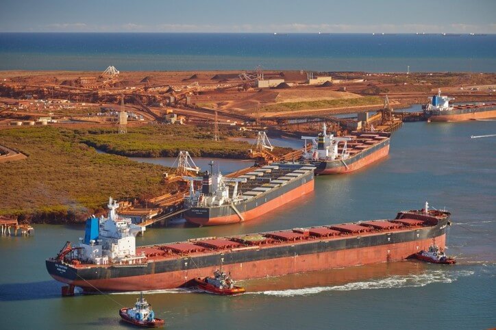
Hedland Port is located in northwestern Australia near the Indian Ocean. It is one of the largest iron ore loading ports in the world and the largest port in Australia.
Port Hedland is adjacent to the ports of Walcott and Dampier and is one of the three main iron ore export ports in the Pilbara region of Western Australia.
In 2019, the tonnage of cargo handled by Port Hedland reached 717 million tons.

History
- Named after Captain Hedland, who was anchored here in 1863, Port Hedland was first developed to meet the needs of local animal husbandry in the East Pilbara. The first wharf was built in 1896. After gold was discovered in the Marble Bar area, it was expanded in 1908.
- Until the 1930s, the port was mainly used for importing and storing goods for local industries, and exporting pearls, shells, wool, livestock, gold, tin and copper. At the end of World War II, the port began to export large amounts of manganese.
- In the 1960s, the iron ore and salt industries witnessed the development of the port.
- Between the 1960s and today and extensive dredging and building has taken Port Hedland from a convenient anchorage to 15 berths capable of loading various ores and goods onto ships ranging from 25,000 DWT to 320,000 DWT.
- In 2005/06 Port Hedland became the first Australian port to export in excess of 100 million tonnes per year.
- In 2010/11 the port exported a record 199 million tonnes, making it the largest port by cargo tonnage in Australia.
- In 2019, the tonnage of cargo handled by Port Hedland reached 717 million tons.

Port
Port Hedland has a natural deep anchor port, which is the main fuel and container terminal in the area, and is considered ideal for the transportation of iron ore mined within the town’s inland areas.
Ore is transported by rail from the four main iron deposits to the east and south of the Port Hedland area. The port exported 519,408,000 tons of iron ore (2017-2018).
Other major resource activities supported by the town include offshore natural gas fields, salt, manganese and livestock. The main deposits of lithium are also being developed and mined in the southern part of the town. Grazing cattle and sheep was once the main source of income in the area, but this situation has gradually declined.
The piers of the harbour are located on both sides of the harbour: Finucane Island to the west and Port Hedland to the east. Ocean-going vessels enter and exit the port through narrow curved channels.

Hedland Port Data
- Country
- Australia
- Region
- Oceania
- Status
- In use
- Location
- Port Hedland, Western Australia
- Operator
- Pilbara Ports Authority
- Opened
- 1896
- Sea area
- Indian Ocean close to Oceania
- Port type
- Deepwater port
- Features
- Natural port, Artificial port
- Annual cargo tonnage
- 717 million tons (2019)
View Hedland Port on Google Satellite Map
Google satellite maps allow you to see building details more clearly, including natural landscapes such as mountains, rivers, deserts, sea and man-made engineering buildings.
If you are very interested in this engineering building, it is a good idea to click below Google Map icon. We will help you jump to the corresponding location of this building or engineering on Google satellite map.


